Latitude: 55.0931 / 55°5'35"N
Longitude: -1.7035 / 1°42'12"W
OS Eastings: 419021
OS Northings: 577666
OS Grid: NZ190776
Mapcode National: GBR J9JK.Z2
Mapcode Global: WHC33.T70X
Plus Code: 9C7W37VW+6J
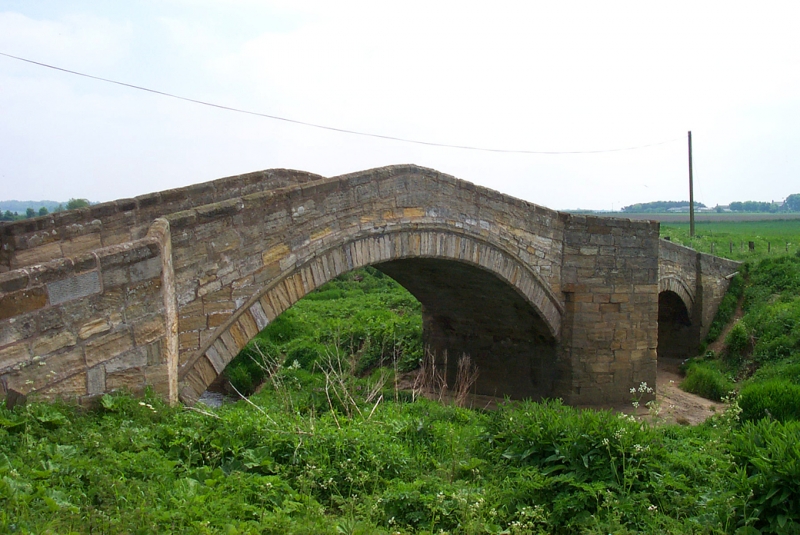
Entry Name: Bellasis Bridge, over the River Blyth
Listing Date: 28 April 1969
Grade: II
Source: Historic England
Source ID: 1370762
English Heritage Legacy ID: 238973
ID on this website: 101370762
Location: Northumberland, NE13
County: Northumberland
Civil Parish: Stannington
Traditional County: Northumberland
Lieutenancy Area (Ceremonial County): Northumberland
Church of England Parish: Stannington St Mary the Virgin
Church of England Diocese: Newcastle
STANNINGTON BELLASIS NZ 17 NE 7/57 Bellasis Bridge, 28.4.69 over the River Blyth II Bridge, probably C16 or C17 with parapet rebuilt C18. Squared stone. Hogback bridge with double-chamfered segmental arch with similar but smaller unchamfered flood arch on south. Between arches a triangular cutwater carried up as a refuge on the west and a shallow rectangular refuge on the east. Parapet with chamfered coping, splayed out at each end.
Scheduled ancient monument.
Listing NGR: NZ1902177666


Other nearby listed buildings