Approximate Location Map
Large Map »
Latitude: 54.9689 / 54°58'7"N
Longitude: -2.1017 / 2°6'5"W
OS Eastings: 393589
OS Northings: 563809
OS Grid: NY935638
Mapcode National: GBR FBRZ.SL
Mapcode Global: WHB2C.PCDN
Plus Code: 9C6VXV9X+G8
Entry Name: Walls to Path Leading to Gaprigg Lane
Listing Date: 18 May 1976
Grade: II
Source: Historic England
Source ID: 1370801
English Heritage Legacy ID: 239076
ID on this website: 101370801
Location: Hexham, Northumberland, NE46
County: Northumberland
Civil Parish: Hexham
Built-Up Area: Hexham
Traditional County: Northumberland
Lieutenancy Area (Ceremonial County): Northumberland
Church of England Parish: Hexham
Church of England Diocese: Newcastle
Tagged with: Wall
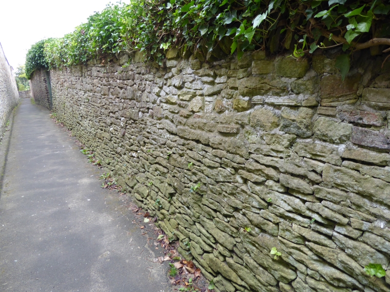
EASTGATE
1. (West Side)
5334
Walls to path
leading to Gaprigg Lane
NY 9363 2/212
II
2.
Early-mid C19. Former garden walls, approached by steps from Eastgate. 12 ft.
high rubble built, about 50 yds long to south - one blocked quoined doorway.
Similar wall about 8 ft high to north about 35 Yds. long.
Listing NGR: NY9358963809
External links are from the relevant listing authority and, where applicable, Wikidata. Wikidata IDs may be related buildings as well as this specific building. If you want to add or update a link, you will need to do so by editing the Wikidata entry.


Other nearby listed buildings
