Approximate Location Map
Large Map »
Latitude: 55.3467 / 55°20'48"N
Longitude: -1.6121 / 1°36'43"W
OS Eastings: 424694
OS Northings: 605922
OS Grid: NU246059
Mapcode National: GBR K65M.S5
Mapcode Global: WHC1T.6WK0
Plus Code: 9C7W89WQ+M4
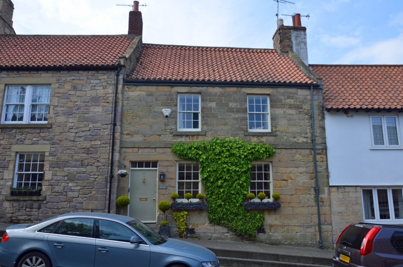
Entry Name: 6, Castle Street
Listing Date: 1 September 1988
Grade: II
Source: Historic England
Source ID: 1371230
English Heritage Legacy ID: 237170
ID on this website: 101371230
Location: Warkworth, Northumberland, NE65
County: Northumberland
Civil Parish: Warkworth
Built-Up Area: Warkworth
Traditional County: Northumberland
Lieutenancy Area (Ceremonial County): Northumberland
Church of England Parish: Warkworth St Lawrence
Church of England Diocese: Newcastle
Tagged with: Building
NU 2405 WARKWORTH CASTLE STREET
(West side)
22/279 No. 6
GV II
House, early C19. Squared stone; C20 pantile roof and brick stack. 2 storeys,
2 bays. Plinth, 1st-floor band. Left end flush-panelled door with 4-pane
overlight. 12-pane sash windows with slightly-projecting sills. Coped right
gable with end stack.
Listing NGR: NU2469005922
External links are from the relevant listing authority and, where applicable, Wikidata. Wikidata IDs may be related buildings as well as this specific building. If you want to add or update a link, you will need to do so by editing the Wikidata entry.


Other nearby listed buildings
