Latitude: 55.2885 / 55°17'18"N
Longitude: -1.884 / 1°53'2"W
OS Eastings: 407466
OS Northings: 599376
OS Grid: NZ074993
Mapcode National: GBR H789.X1
Mapcode Global: WHC22.1B4N
Plus Code: 9C7W74Q8+9C
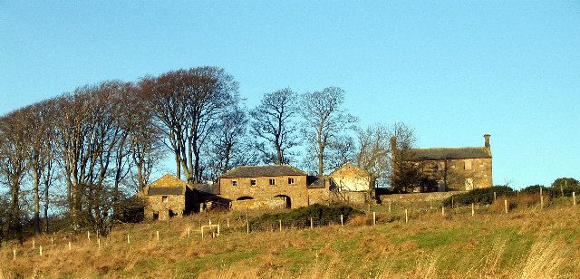
Entry Name: Farmbuildings West of Pike House
Listing Date: 29 May 1987
Grade: II
Source: Historic England
Source ID: 1371443
English Heritage Legacy ID: 236282
ID on this website: 101371443
Location: Northumberland, NE61
County: Northumberland
Civil Parish: Hesleyhurst
Traditional County: Northumberland
Lieutenancy Area (Ceremonial County): Northumberland
Church of England Parish: Upper Coquetdale
Church of England Diocese: Newcastle
Tagged with: Agricultural structure
HESLEYHURST PIKE HOUSE NZ 09 NE 8/42 Farmbuildings west of Pike House
GV II
Planned farm buildings. Early C19. Coursed stone with ashlar dressings. Welsh slate roof. Symmetrical U-plan.
Rear range has 2-storey central section with 2 segmental arches to shelter sheds on ground floor and four 4-pane Yorkshire sashes above. Stone eaves and hipped roof.
Single-storey, one-bay flanking sections with boarded door to left, blocked door to right.
Projecting single-storey, 2-bay byres, each with 2 boarded doors and 2 ventilation slits. Gabled roofs with flat coping.
Lean-tos against gable ends of projecting ranges. To left 2 pigsties with exercise yards in front and henhouse over. To right kennels and exercise yards and iron railings in front
Interior of henhouse has stone nesting boxes.
Listing NGR: NZ0746699376
External links are from the relevant listing authority and, where applicable, Wikidata. Wikidata IDs may be related buildings as well as this specific building. If you want to add or update a link, you will need to do so by editing the Wikidata entry.


Other nearby listed buildings