Latitude: 52.2998 / 52°17'59"N
Longitude: -0.691 / 0°41'27"W
OS Eastings: 489359
OS Northings: 267658
OS Grid: SP893676
Mapcode National: GBR DYF.S57
Mapcode Global: VHDRW.ZG2B
Plus Code: 9C4X78X5+WJ
Entry Name: Borough of Wellingborough Environmental Health Department
Listing Date: 23 September 1950
Last Amended: 12 March 1986
Grade: II
Source: Historic England
Source ID: 1371752
English Heritage Legacy ID: 233805
ID on this website: 101371752
Location: Wellingborough, North Northamptonshire, NN8
County: North Northamptonshire
Electoral Ward/Division: Swanspool
Parish: Wellingborough
Built-Up Area: Wellingborough
Traditional County: Northamptonshire
Lieutenancy Area (Ceremonial County): Northamptonshire
Church of England Parish: Wellingborough All Saints
Church of England Diocese: Peterborough
Tagged with: Architectural structure
WELLINGBOROUGH SHEEP STREET SP8967NW (East side) 11/144 No.20 (Borough of 23/09/50 Wellingborough Environmental Health Dept.) (Formerly listed as No.20) GV II
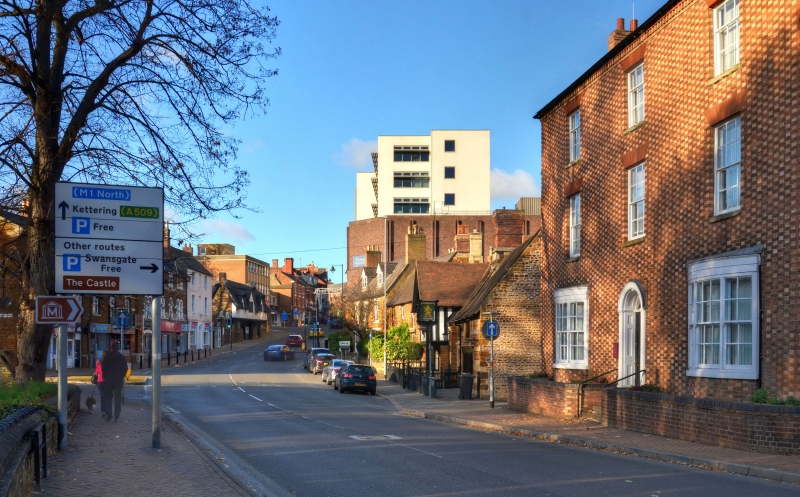
House, now offices. Early C19. Brick with chequered red arid white brick facade and slate roof. Double-depth plan. 3 storeys. 3-window range. Central 6-panelled door has arched fanlight with glazing bars, arched head surround and panelled reveals. Bow windows at ground floor have triple sashes. Sash windows at first and second floor, reducing in height at second floor, all with glazing bars and gauged brick treads. Brick stacks at ends. Interior has early C19 staircase with stick balustrade: some 6-panelled doors and moulded plaster cornices.
Listing NGR: SP8935967658
External links are from the relevant listing authority and, where applicable, Wikidata. Wikidata IDs may be related buildings as well as this specific building. If you want to add or update a link, you will need to do so by editing the Wikidata entry.


Other nearby listed buildings