Approximate Location Map
Large Map »
Latitude: 52.0279 / 52°1'40"N
Longitude: -1.1489 / 1°8'55"W
OS Eastings: 458491
OS Northings: 236953
OS Grid: SP584369
Mapcode National: GBR 8VS.Y2V
Mapcode Global: VHCWK.19H7
Plus Code: 9C4W2VH2+5F
Entry Name: 50, Market Place
Listing Date: 22 April 1950
Grade: II
Source: Historic England
Source ID: 1371807
English Heritage Legacy ID: 233890
ID on this website: 101371807
Location: Brackley, West Northamptonshire, NN13
County: West Northamptonshire
Civil Parish: Brackley
Built-Up Area: Brackley
Traditional County: Northamptonshire
Lieutenancy Area (Ceremonial County): Northamptonshire
Church of England Parish: Brackley
Church of England Diocese: Peterborough
Tagged with: Building
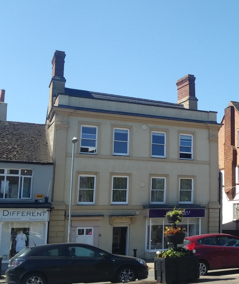
1.
5328
SP 5836
1/12
22.4.50
BRACKLEY
MARKET PLACE
(West Side)
No 50
II
2.
An ancient house, possibly C17. 3-storeyed coursed rubble (vide north side)
with a late C18 roughcast front with a moulded cornice, parapet and Doric side
pilasters. Modern boxed-out shop front with a bracketed flat hood. Plain bands
at 1st and 2nd floors. 2 brick shafts on stone bases. 4 sash windows in moulded
stone frames.
Listing NGR: SP5849136953
External links are from the relevant listing authority and, where applicable, Wikidata. Wikidata IDs may be related buildings as well as this specific building. If you want to add or update a link, you will need to do so by editing the Wikidata entry.


Other nearby listed buildings
