Approximate Location Map
Large Map »
Latitude: 51.2927 / 51°17'33"N
Longitude: 1.2538 / 1°15'13"E
OS Eastings: 626956
OS Northings: 159864
OS Grid: TR269598
Mapcode National: GBR VZF.ZRX
Mapcode Global: VHLGJ.PR6X
Plus Code: 9F3377V3+3G
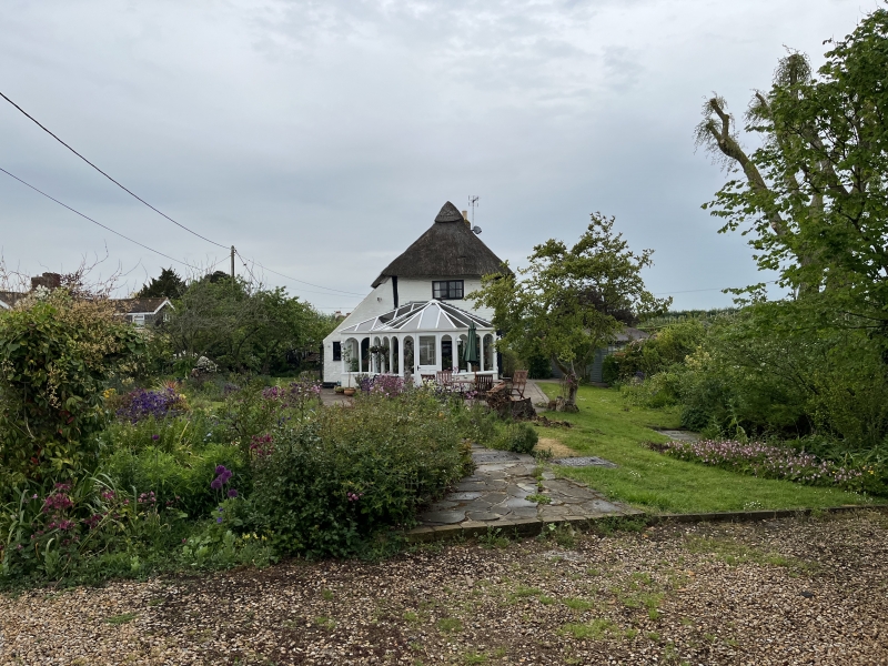
Entry Name: Cherry Thatch
Listing Date: 11 October 1963
Grade: II
Source: Historic England
Source ID: 1372271
English Heritage Legacy ID: 178051
ID on this website: 101372271
Location: Hoaden, Dover, Kent, CT3
County: Kent
District: Dover
Civil Parish: Ash
Traditional County: Kent
Lieutenancy Area (Ceremonial County): Kent
Tagged with: Architectural structure Thatched cottage
ASH HOADEN
TR 25 NE
5/21 Cherry Thatch
11.10.63
GV II
House. C17. Timber framed with painted brick cladding and infill.
Thatched roof. One storey and garret with pantiled oushot along entire
ground floor. Roof has a gable to the left and a hip to the right with
stack at end left. Three-light wooden casement to left, 2-light to right
and central C20 rib and stud door with flat hood. C20 wooden and aluminium
conservatory on right return.
Listing NGR: TR2695659864
External links are from the relevant listing authority and, where applicable, Wikidata. Wikidata IDs may be related buildings as well as this specific building. If you want to add or update a link, you will need to do so by editing the Wikidata entry.


Other nearby listed buildings
