Latitude: 52.6244 / 52°37'27"N
Longitude: 1.2953 / 1°17'43"E
OS Eastings: 623136
OS Northings: 308057
OS Grid: TG231080
Mapcode National: GBR W98.QN
Mapcode Global: WHMTM.W90F
Plus Code: 9F43J7FW+Q4
Entry Name: 41, All Saints Green
Listing Date: 26 February 1954
Grade: II
Source: Historic England
Source ID: 1372746
English Heritage Legacy ID: 228748
ID on this website: 101372746
Location: Norwich, Norfolk, NR1
County: Norfolk
District: Norwich
Electoral Ward/Division: Mancroft
Parish: Non Civil Parish
Built-Up Area: Norwich
Traditional County: Norfolk
Lieutenancy Area (Ceremonial County): Norfolk
Church of England Parish: Norwich St John, Timberhill
Church of England Diocese: Norwich
Tagged with: Building
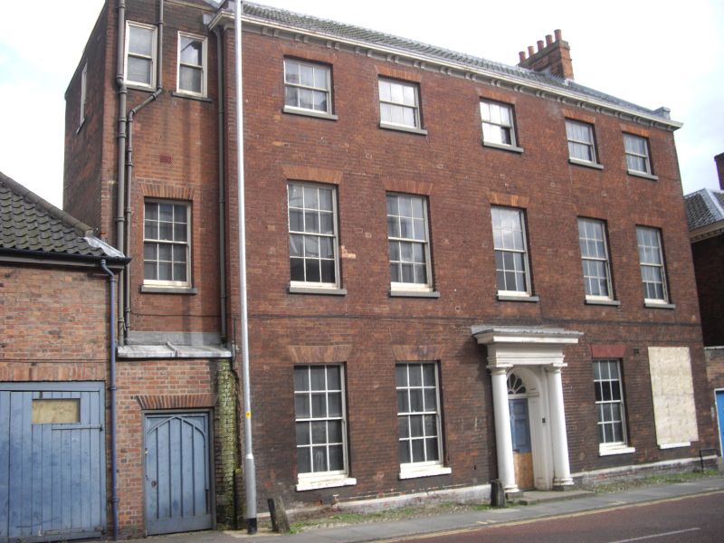
TG 2308 SW. ALL SAINTS GREEN
23/13 (east side)
26.2.54. No.41
GV. II.
Former house now offices. C18. Red brick and black pantiles. 3 storeys 5 bays.
Central door with attached Doric columns supporting architrave and flat hood,
Sash windows throughout with glazing bars and rubbed brick flat arches. Paired
bracket cornice. Norwich fire mark.
Listing NGR: TG2313608056
External links are from the relevant listing authority and, where applicable, Wikidata. Wikidata IDs may be related buildings as well as this specific building. If you want to add or update a link, you will need to do so by editing the Wikidata entry.


Other nearby listed buildings