Approximate Location Map
Large Map »
Latitude: 52.9017 / 52°54'6"N
Longitude: -1.8659 / 1°51'57"W
OS Eastings: 409116
OS Northings: 333818
OS Grid: SK091338
Mapcode National: GBR 38R.32M
Mapcode Global: WHCFP.9BQ9
Plus Code: 9C4WW42M+MJ
Entry Name: 90, High Street
Listing Date: 24 October 1950
Grade: II
Source: Historic England
Source ID: 1374328
English Heritage Legacy ID: 272922
ID on this website: 101374328
Location: The Wharf, East Staffordshire, ST14
County: Staffordshire
District: East Staffordshire
Civil Parish: Uttoxeter
Built-Up Area: Uttoxeter
Traditional County: Staffordshire
Lieutenancy Area (Ceremonial County): Staffordshire
Church of England Parish: Uttoxeter St Mary Virgin
Church of England Diocese: Lichfield
Tagged with: Building
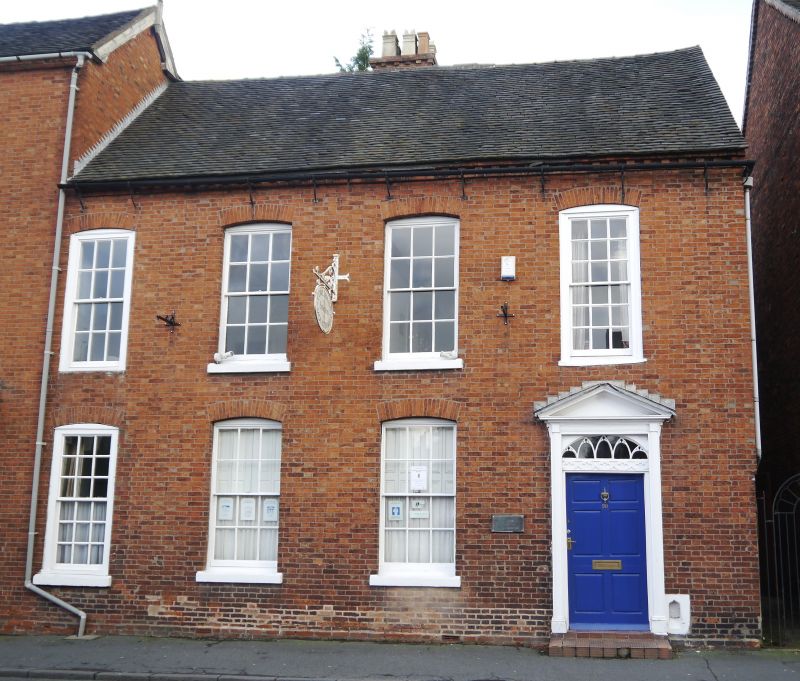
HIGH STREET
1.
1756
(East Side)
No 90
SK 0933 1/30 24.10.50.
II GV
2.
Mid C18. Red brick; 2 storeys; 4 sash windows; door with 6 fielded panels
in later wood case with pediment and "Gothic" glazed fanlight; brick eaves
cornice; old tiles.
Wellington Inn and Nos 80 to 92 (even) form a group.
Listing NGR: SK0911633818
External links are from the relevant listing authority and, where applicable, Wikidata. Wikidata IDs may be related buildings as well as this specific building. If you want to add or update a link, you will need to do so by editing the Wikidata entry.


Other nearby listed buildings
