Latitude: 52.9763 / 52°58'34"N
Longitude: -1.8939 / 1°53'38"W
OS Eastings: 407220
OS Northings: 342114
OS Grid: SK072421
Mapcode National: GBR 37R.G02
Mapcode Global: WHBD4.WG94
Plus Code: 9C4WX4G4+GC
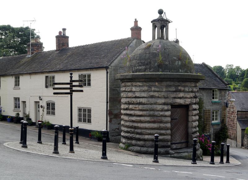
Entry Name: The Lock Up
Listing Date: 3 January 1967
Grade: II
Source: Historic England
Source ID: 1374689
English Heritage Legacy ID: 275009
ID on this website: 101374689
Location: Alton, Staffordshire Moorlands, Staffordshire, ST10
County: Staffordshire
District: Staffordshire Moorlands
Civil Parish: Alton
Built-Up Area: Alton
Traditional County: Staffordshire
Lieutenancy Area (Ceremonial County): Staffordshire
Church of England Parish: Alton St Peter
Church of England Diocese: Lichfield
Tagged with: Architectural structure Village lock-up
ALTON C.P. DIMBLE LANE (West side)
SK 0642-0742
13/13 The Lock Up
3/1/67
GV
II
Shown on OS Map as Round House.
Lock-up. 1819. Rock faced ashlar with ashlar dome and cupola.
Circular plan. One-storey with hemispherical dome surmounted by a
cupola with ball finial; door to the north (A.M.). B.O.E. p. 55.
Listing NGR: SK0722042114
External links are from the relevant listing authority and, where applicable, Wikidata. Wikidata IDs may be related buildings as well as this specific building. If you want to add or update a link, you will need to do so by editing the Wikidata entry.


Other nearby listed buildings