Latitude: 52.2437 / 52°14'37"N
Longitude: 0.7193 / 0°43'9"E
OS Eastings: 585753
OS Northings: 264100
OS Grid: TL857641
Mapcode National: GBR QF0.8PG
Mapcode Global: VHKD4.FV4T
Plus Code: 9F426PV9+FP
Entry Name: Ruins of Abbey Church of St Edmund
Listing Date: 7 August 1952
Last Amended: 30 October 1997
Grade: I
Source: Historic England
Source ID: 1375540
English Heritage Legacy ID: 466441
ID on this website: 101375540
Location: Abbey Gardens, Bury St Edmunds, West Suffolk, IP33
County: Suffolk
District: West Suffolk
Civil Parish: Bury St Edmunds
Built-Up Area: Bury St Edmunds
Traditional County: Suffolk
Lieutenancy Area (Ceremonial County): Suffolk
Church of England Parish: St James Bury St Edmunds
Church of England Diocese: St.Edmundsbury and Ipswich
Tagged with: Church building Church ruin
TL8564SE
639-1/8/94
07/08/52
BURY ST EDMUNDS
ABBEY PRECINCTS
Ruins of Abbey Church of St Edmund
(Formerly Listed as:
ABBEY PRECINCTS Abbey Ruins)
GV
I
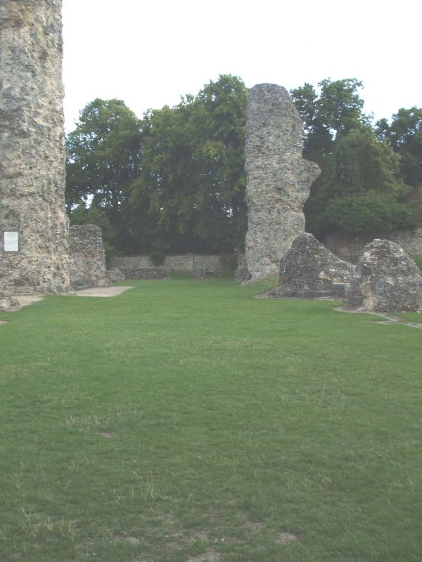
Ruins of the Abbey Church of St Edmund, excluding the West
Front (qv), which is included separately. C11 and C12. In
flint rubble, with the remains of stone dressings.
EXTERIOR: the church was 505 feet long. The nave, extended
into 12 bays under Abbot Anselm (1121-1148), was arcaded on
both sides: little now remains but the rubble bases of several
of the columns. More complete are the 2 large transepts which
had eastern aisles and 2 apsidal chapels on each side, one on
the north replaced by a Lady Chapel in 1275. Parts of the high
crossing arches supporting the central tower are today the
tallest parts of the ruins.
The crossing tower, begun just after 1100, was completed by
Abbot Anselm, but damaged later and rebuilt in stages from
1361. Beyond the site of the High Altar the ground drops
sharply: the 5-bay chancel is missing but the crypt below it,
which is the oldest surviving part of the Abbey, built under
Abbot Baldwin soon after 1066, is clearly laid out: the outer
walls rise above the level of the former window sills and the
bases of most of the columns along the line of the ambulatory
remain. The form is apsidal, with 3 chapels at the east end,
the 2 to each side of the apse semicircular. The plan of the
chancel itself was similar, with an ambulatory and 3 radiating
chapels at the east end.
Scheduled Ancient Monument.
(BOE: Pevsner N: Radcliffe E: Suffolk: London: 1974-: 139).
Listing NGR: TL8575364100
External links are from the relevant listing authority and, where applicable, Wikidata. Wikidata IDs may be related buildings as well as this specific building. If you want to add or update a link, you will need to do so by editing the Wikidata entry.


Other nearby listed buildings