Latitude: 53.1747 / 53°10'28"N
Longitude: -2.8849 / 2°53'5"W
OS Eastings: 340946
OS Northings: 364538
OS Grid: SJ409645
Mapcode National: GBR 7B.41PY
Mapcode Global: WH88F.NGFL
Plus Code: 9C5V54F8+V2
Entry Name: Walls and Piers to Front of Greenbank
Listing Date: 10 January 1972
Last Amended: 23 July 1998
Grade: II
Source: Historic England
Source ID: 1375778
English Heritage Legacy ID: 469757
ID on this website: 101375778
Location: Handbridge, Cheshire West and Chester, Cheshire, CH4
County: Cheshire West and Chester
Electoral Ward/Division: Handbridge Park
Parish: Non Civil Parish
Built-Up Area: Chester
Traditional County: Cheshire
Lieutenancy Area (Ceremonial County): Cheshire
Church of England Parish: Chester St Mary without the Walls
Church of England Diocese: Chester
Tagged with: Wall
CHESTER CITY (EM)
SJ46SW EATON ROAD 1932-1/4/81 (East side) 10/01/72 Walls and piers to front of Greenbank (Formerly Listed as: EATON ROAD Stone wall and gate piers to Green Bank)
GV II
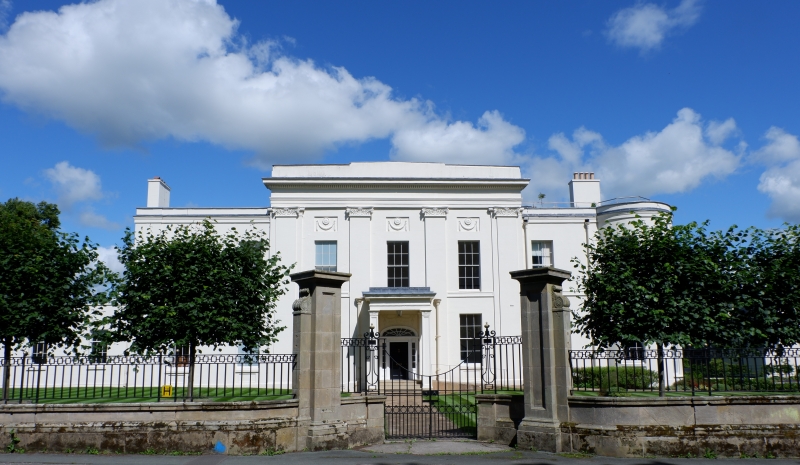
Walls and gate piers to frontage of Greenbank (qv). Probably c1930 by Sir Charles Reilly for Peter Jones. Yellow sandstone ashlar. Wall approx 1 metre high has a row of shallow panels beneath the moulded cornice. Rectangular piers to three pairs of gates have plinths, long panels to front, side-wings with volutes and cornices; square piers to ends and corners of walls. The railings and gates by the Birmingham Guild are lost; simpler replacements designed by Cheshire County Architect's Department c1980 have bottom rail, dogbars, double middle rail divided by circlets, Greek key-pattern between double top-rails. (The Buildings of England: Pevsner N & Hubbard E: Cheshire: Harmondsworth: 1971-).
Listing NGR: SJ4094664538
External links are from the relevant listing authority and, where applicable, Wikidata. Wikidata IDs may be related buildings as well as this specific building. If you want to add or update a link, you will need to do so by editing the Wikidata entry.


Other nearby listed buildings