Latitude: 51.4047 / 51°24'16"N
Longitude: -0.4111 / 0°24'39"W
OS Eastings: 510616
OS Northings: 168489
OS Grid: TQ106684
Mapcode National: GBR 3Y.91J
Mapcode Global: VHFTR.TYJK
Plus Code: 9C3XCH3Q+VH
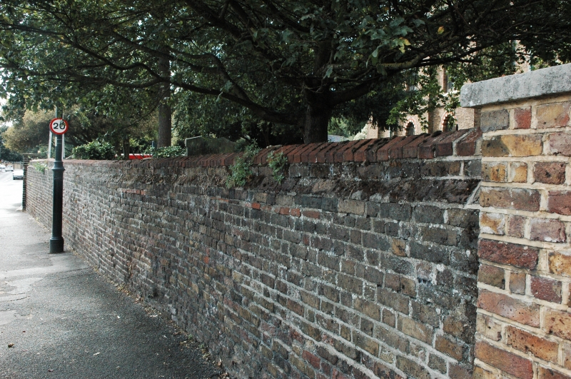
Entry Name: Retaining Wall Around the Churchyard of the Church of St Mary the Virgin
Listing Date: 24 September 1987
Grade: II
Source: Historic England
Source ID: 1377694
English Heritage Legacy ID: 287998
ID on this website: 101377694
Location: Spelthorne, Surrey, TW16
County: Surrey
District: Spelthorne
Electoral Ward/Division: Sunbury East
Parish: Non Civil Parish
Built-Up Area: Walton-on-Thames
Traditional County: Middlesex
Lieutenancy Area (Ceremonial County): Surrey
Church of England Parish: St Mary Sunbury-on-Thames
Church of England Diocese: London
Tagged with: Retaining wall
TQ 16NW SUNBURY-ON-THAMES, FORMER UD CHURCH STREET Sunbury 4/26 Retaining wall around the Churchyard of the Church of St. Mary the Virgin
GV II
Wall and gates. Late C18 with C19 and C20 alterations. Brown brick. 4 feet high on Church Street frontage with offset to top and brick coping. Rising up with tiled coping to end gate on north corner adjacent to Old Manor Farm; gate of wrought iron with spear heads. Wall extends approximately 80 feet to new red brick and stone entrance opposite west door of Church. Further 80 feet length from west door to corner of Church Street and Thames Street, the wall rising to approx 5 feet as ground drops away. Curved corner and approximately 3 feet either side of double gates between 6 feet high piers on Thames Street, south of church. Gates with spear rails and open standards with scroll work and curved bracket overthrows with urn finials. Single gate to east, at corner of churchyard.
Listing NGR: TQ1061668489
External links are from the relevant listing authority and, where applicable, Wikidata. Wikidata IDs may be related buildings as well as this specific building. If you want to add or update a link, you will need to do so by editing the Wikidata entry.


Other nearby listed buildings