Approximate Location Map
Large Map »
Latitude: 50.807 / 50°48'25"N
Longitude: -0.0565 / 0°3'23"W
OS Eastings: 537035
OS Northings: 102628
OS Grid: TQ370026
Mapcode National: GBR KQR.BK5
Mapcode Global: FRA B6RY.ZRM
Plus Code: 9C2XRW4V+RC
Entry Name: Tudor Close
Listing Date: 14 September 1993
Grade: II
Source: Historic England
Source ID: 1380426
English Heritage Legacy ID: 480539
ID on this website: 101380426
Location: Rottingdean, Brighton and Hove, West Sussex, BN2
County: The City of Brighton and Hove
Civil Parish: Rottingdean
Built-Up Area: Saltdean
Traditional County: Sussex
Lieutenancy Area (Ceremonial County): East Sussex
Church of England Parish: Rottingdean St Margaret
Church of England Diocese: Chichester
Tagged with: Building
BRIGHTON
TQ3702NW DEAN COURT ROAD, Rottingdean
577-1/61/1048 (South side)
14/09/93 Nos 1-9 (consecutive) and 16-29
(consecutive) Tudor Close
GV II
Formerly known as: Tudor Close DEAN COURT ROAD Rottingdean.
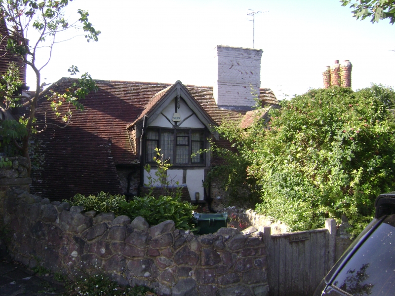
A group of contiguous houses, now houses and flats. c1929.
Developed by the Saltdean Estate Company. The houses became
the Tudor Close Hotel shortly after 1929, were extended to the
designs of Richard Jones in 1936-7, and were reconverted into
houses and flats in the 1950s.
Flint with brick dressings principally, and some
timber-framing with infill of plaster or brick nogging; roof
of tiles.
EXTERIOR/PLAN: the buildings incorporated 2 former barns and a
cow-shed from Court Farm, and timber and tiles were taken from
other old buildings. One and 2 storeys with dormers.
The houses are built round 3 sides of 2 stone-paved
courtyards. Those to the western courtyard (Nos 1-7 consec)
have as their principal features, half-timbered, gabled
2-storeyed porches; Tudor-arched windows in groups of 3 and 4
with wooden mullions; jettied and gabled upper storeys;
ornamental carving, most notably on the bargeboards; brick
chimneys of strikingly various designs; and terracing to the
courtyard.
The south wing is shorter than the north, and the east wing
has, in the centre, a particularly ornate porch with stained
glass in the top- and side-lights.
The courtyard to the east is detailed in the same way, though
slightly more quietly, and the houses have jettied upper
storeys with entrances through French windows instead of
porches; and the chimneystacks have been removed. Because of
the lie of the land, entrances to the northern and eastern
ranges of this group are at first-floor level, with noticeably
elaborate details to the bargeboards over the entrances.
(Carder T: The Encyclopaedia of Brighton: Lewes: 1990-).
Listing NGR: TQ3703502628
External links are from the relevant listing authority and, where applicable, Wikidata. Wikidata IDs may be related buildings as well as this specific building. If you want to add or update a link, you will need to do so by editing the Wikidata entry.


Other nearby listed buildings
