Latitude: 52.2856 / 52°17'8"N
Longitude: -1.5332 / 1°31'59"W
OS Eastings: 431937
OS Northings: 265375
OS Grid: SP319653
Mapcode National: GBR 6NJ.P61
Mapcode Global: VHBXJ.CTT7
Plus Code: 9C4W7FP8+6P
Entry Name: 30, Bath Street
Listing Date: 25 March 1970
Grade: II
Source: Historic England
Source ID: 1381135
English Heritage Legacy ID: 481495
ID on this website: 101381135
Location: Royal Leamington Spa, Warwick, Warwickshire, CV31
County: Warwickshire
District: Warwick
Civil Parish: Royal Leamington Spa
Built-Up Area: Royal Leamington Spa
Traditional County: Warwickshire
Lieutenancy Area (Ceremonial County): Warwickshire
Church of England Parish: Leamington Priors All Saints
Church of England Diocese: Coventry
Tagged with: Building
This list entry was subject to a Minor Amendment on 9 April 2025 to update the Address and reformat the text to current standards
SP3165SE
1208-1/8/20
ROYAL LEAMINGTON SPA
BATH STREET (West side)
No.30
25/03/70
GV
II
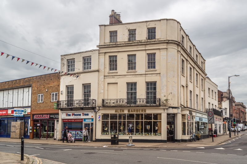
House, now shop with flat over. c1818-1836 with later additions and alterations including mid-late C20 ground floor and shop front. Pinkish-brown brick in English Garden Wall bond, Welsh slate roof and cast-iron balcony.
Three storeys, two first-floor windows. First floor: 6/9 full-height sashes. Ovolo-moulded cornice. Second floor: 3/6 sashes. All windows in plain reveals. Low parapet with copings. Peaked roof. End stack. First floor has continuous Carron Company double-heart-and-anthemion motif balcony.
INTERIOR: not inspected.
HISTORICAL NOTE: Bath Street was a main street of the C18 village of Leamington.
Forms a group with Nos 26 and 28 (qv).
(Dept of the Environment List of Buildings: Royal Leamington Spa: 1970-).
Listing NGR: SP3193765375
External links are from the relevant listing authority and, where applicable, Wikidata. Wikidata IDs may be related buildings as well as this specific building. If you want to add or update a link, you will need to do so by editing the Wikidata entry.


Other nearby listed buildings