Approximate Location Map
Large Map »
Latitude: 52.2804 / 52°16'49"N
Longitude: -1.7203 / 1°43'13"W
OS Eastings: 419175
OS Northings: 264729
OS Grid: SP191647
Mapcode National: GBR 4KT.3VC
Mapcode Global: VHBXF.4YC7
Plus Code: 9C4W77JH+5V
Entry Name: Breach Farmhouse
Listing Date: 2 August 1972
Grade: II
Source: Historic England
Source ID: 1382057
English Heritage Legacy ID: 482422
ID on this website: 101382057
Location: Claverdon, Stratford-on-Avon, Warwickshire, CV35
County: Warwickshire
District: Stratford-on-Avon
Civil Parish: Claverdon
Traditional County: Warwickshire
Lieutenancy Area (Ceremonial County): Warwickshire
Church of England Parish: Claverdon St Michael and All Angels
Church of England Diocese: Coventry
Tagged with: Farmhouse
CLAVERDON
SP16SE BREACH LANE
1457-1/5/14 (West side)
02/08/72 Breach Farmhouse
II
Also known as: Breach Manor BREACH LANE.
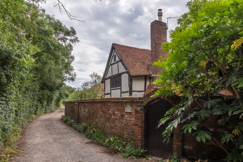
Farmhouse, now house. C17, with C19 wing attached to right at
rear and continuous outshut to rear at left under catslide
roof, with restorations, additions and alterations 1980s.
Timber-framed with painted plaster infill and reddish-brown
brick to left part and to right gable end, stone plinth to
left part, plain-tile roofs, brick stacks.
Elongated L-shape on plan with further range to front.
EXTERIOR: single-storey, plus attic, with 3 bays. Small panels
of square timber-framing to left part. Plinth. Entrance to
front at right with further entrances to rear and to right
range, all with C20 plank doors and moulded wood surrounds.
Renewed 2- and 3-light casement windows to ground and attic
floors, those to brick part under elliptical arches.
Right and left gables have exposed rafters crossed at apex and
trenched purlins. Massive external stack to corner of front
range and front extension. Gabled roofs. Ridge and lateral
stacks.
INTERIOR: walls have square panels of timber-framing visible
to front part and with some close studding to right part.
Inglenook fireplace with bressumer beam to rear left. Exposed
chamfered beams and rafters.
Listing NGR: SP1917564729
External links are from the relevant listing authority and, where applicable, Wikidata. Wikidata IDs may be related buildings as well as this specific building. If you want to add or update a link, you will need to do so by editing the Wikidata entry.


Other nearby listed buildings
