Latitude: 51.2089 / 51°12'31"N
Longitude: -2.6501 / 2°39'0"W
OS Eastings: 354684
OS Northings: 145717
OS Grid: ST546457
Mapcode National: GBR MN.42DP
Mapcode Global: VH89S.0WV5
Plus Code: 9C3V685X+GX
Entry Name: 11, Priest Row
Listing Date: 13 September 1972
Grade: II
Source: Historic England
Source ID: 1383062
English Heritage Legacy ID: 483480
ID on this website: 101383062
Location: Wells, Somerset, BA5
County: Somerset
District: Mendip
Civil Parish: Wells
Built-Up Area: Wells
Traditional County: Somerset
Lieutenancy Area (Ceremonial County): Somerset
Tagged with: Building
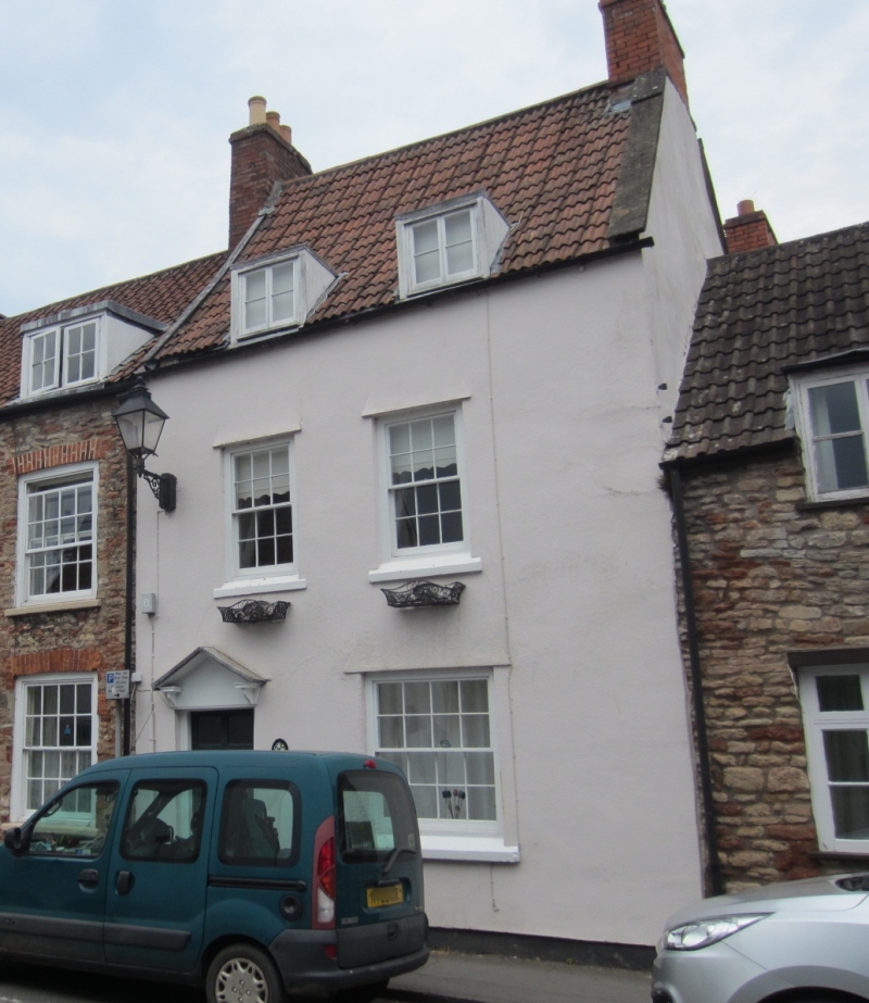
WELLS
ST5445 PRIEST ROW
662-1/7/198 (East side)
13/09/72 No.11
GV II
House in row. Early/mid C19, modified in C20. Rendered and
colourwashed over rubble, triple-roll clay tiles with plain
gable to north and coped gable to south, brick chimney stack.
EXTERIOR: 2 storeys with attic, 2 bays. Mid C20 casement
windows, mid C20 part-glazed door to lower bay 1, with C19
open pediment timber hood on brackets. 2 flat roofed dormers
with casement windows.
INTERIOR: not inspected.
Listing NGR: ST5468545718
External links are from the relevant listing authority and, where applicable, Wikidata. Wikidata IDs may be related buildings as well as this specific building. If you want to add or update a link, you will need to do so by editing the Wikidata entry.


Other nearby listed buildings