Approximate Location Map
Large Map »
Latitude: 52.3786 / 52°22'42"N
Longitude: -2.4821 / 2°28'55"W
OS Eastings: 367279
OS Northings: 275725
OS Grid: SO672757
Mapcode National: GBR BW.R9N4
Mapcode Global: VH847.XGPY
Plus Code: 9C4V9GH9+C5
Entry Name: Remains of Wayside Cross 18 Metres West of K6 Telephone Kiosk
Listing Date: 12 November 1954
Grade: II
Source: Historic England
Source ID: 1383480
English Heritage Legacy ID: 483898
ID on this website: 101383480
Location: Cleobury Mortimer, Shropshire, DY14
County: Shropshire
Civil Parish: Cleobury Mortimer
Built-Up Area: Cleobury Mortimer
Traditional County: Shropshire
Lieutenancy Area (Ceremonial County): Shropshire
Church of England Parish: Cleobury Mortimer
Church of England Diocese: Hereford
CLEOBURY MORTIMER
SO6775 HIGH STREET
582-1/13/73 (North side)
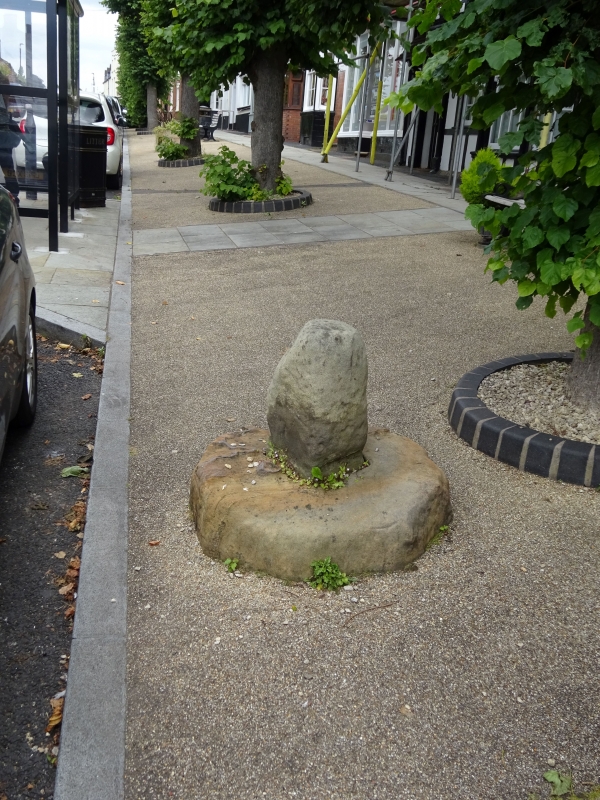
12/11/54 Remains of Wayside Cross 18 metres
west of K6 Telephone Kiosk
GV II
Remnants of wayside cross. Medieval. Ashlar. Single octagonal
slab base. Lower section of approx O.5 metre of shaft only
survives. Both sections badly weathered.
Listing NGR: SO6727575722
External links are from the relevant listing authority and, where applicable, Wikidata. Wikidata IDs may be related buildings as well as this specific building. If you want to add or update a link, you will need to do so by editing the Wikidata entry.


Other nearby listed buildings
