Latitude: 52.1086 / 52°6'31"N
Longitude: -2.0739 / 2°4'25"W
OS Eastings: 395036
OS Northings: 245592
OS Grid: SO950455
Mapcode National: GBR 2JM.QH9
Mapcode Global: VHB0R.08GC
Plus Code: 9C4V4W5G+FC
Entry Name: 40, Bridge Street
Listing Date: 11 February 1965
Grade: II
Source: Historic England
Source ID: 1386953
English Heritage Legacy ID: 474369
ID on this website: 101386953
Location: Pershore, Wychavon, Worcestershire, WR10
County: Worcestershire
District: Wychavon
Civil Parish: Pershore
Built-Up Area: Pershore
Traditional County: Worcestershire
Lieutenancy Area (Ceremonial County): Worcestershire
Church of England Parish: Pershore
Church of England Diocese: Worcester
Tagged with: Building
PERSHORE
SO9545 BRIDGE STREET 648-1/5/36 (West side) 11/02/65 No.40
GV II
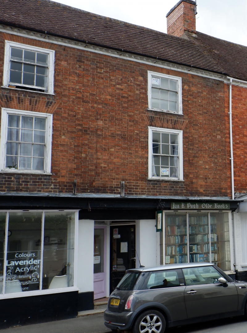
House now incorporating 2 shops. Mid - late C18. Red brick in Flemish bond. Plain tile roof with painted brick dogtooth eaves and brick end-stack to left. EXTERIOR: 3 storeys and cellar. 2-window range, on 1st floor of 6/6-pane horned boxed sashes under gauged brick flat arches; similar smaller 3/6 sashes above. Ground floor: full-width moulded fascia with board soffit; two C19 shopfronts, each having a bay-window with plate glazing divided by 4 deep angled mullions; 2 stone steps up to central internal porch within which are the doors to the two shops, angled and part-glazed; deep painted plinth with cellar grille. INTERIOR: not inspected. HISTORICAL NOTE: former grocer's business, with warehouse (now cottages) to rear (not included).
Listing NGR: SO9503645592
External links are from the relevant listing authority and, where applicable, Wikidata. Wikidata IDs may be related buildings as well as this specific building. If you want to add or update a link, you will need to do so by editing the Wikidata entry.


Other nearby listed buildings