Latitude: 50.7785 / 50°46'42"N
Longitude: -1.0831 / 1°4'59"W
OS Eastings: 464744
OS Northings: 98060
OS Grid: SZ647980
Mapcode National: GBR BDH.30M
Mapcode Global: FRA 87M1.1VT
Plus Code: 9C2WQWH8+CQ
Entry Name: Seafront Shelter at SZ 6474 9806
Listing Date: 18 March 1999
Grade: II
Source: Historic England
Source ID: 1386981
English Heritage Legacy ID: 474397
ID on this website: 101386981
Location: Southsea, Portsmouth, Hampshire, PO5
County: City of Portsmouth
Electoral Ward/Division: St Jude
Parish: Non Civil Parish
Traditional County: Hampshire
Lieutenancy Area (Ceremonial County): Hampshire
Church of England Parish: Southsea St Simon
Church of England Diocese: Portsmouth
Tagged with: Architectural structure
PORTSMOUTH
SZ6498 CLARENCE ESPLANADE, Southsea 774-1/15/333 Seafront Shelter at SZ 6474 9806
II
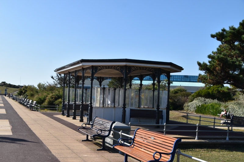
Seafront shelter. c1900. Cast-iron and timber. Flat composition sheeted roof. Rectangular plan with splayed corners, open arcaded perimeter. On each side are 5 and at each end 2 ornate cast-iron columns with stiff leaf capital and bulbous base supporting 4 round timber arches to sides and 3 elliptical end arches. Running east and west through centre is a low screen double splayed at ends with vertical boarding to dado, short twisted cast-iron columns each with Corinthian capital supporting moulded horizontal top bar, iron ball on moulded base over each capital. Between columns are 3 light fixed glazed panels. On each side of screen are horizontal open slated varnished timber benches with shaped cast-iron supports each with curved arm support rails.
Listing NGR: SZ6474098060
External links are from the relevant listing authority and, where applicable, Wikidata. Wikidata IDs may be related buildings as well as this specific building. If you want to add or update a link, you will need to do so by editing the Wikidata entry.


Other nearby listed buildings