Approximate Location Map
Large Map »
Latitude: 52.1104 / 52°6'37"N
Longitude: -2.0752 / 2°4'30"W
OS Eastings: 394946
OS Northings: 245787
OS Grid: SO949457
Mapcode National: GBR 2JM.Q4T
Mapcode Global: VH938.Z790
Plus Code: 9C4V4W6F+5W
Entry Name: 14, High Street
Listing Date: 11 February 1965
Grade: II
Source: Historic England
Source ID: 1387063
English Heritage Legacy ID: 474479
ID on this website: 101387063
Location: Pershore, Wychavon, Worcestershire, WR10
County: Worcestershire
District: Wychavon
Civil Parish: Pershore
Built-Up Area: Pershore
Traditional County: Worcestershire
Lieutenancy Area (Ceremonial County): Worcestershire
Church of England Parish: Pershore
Church of England Diocese: Worcester
Tagged with: Building
PERSHORE
SO9445 HIGH STREET
648-1/5/120 (West side)
11/02/65 No.14
GV II
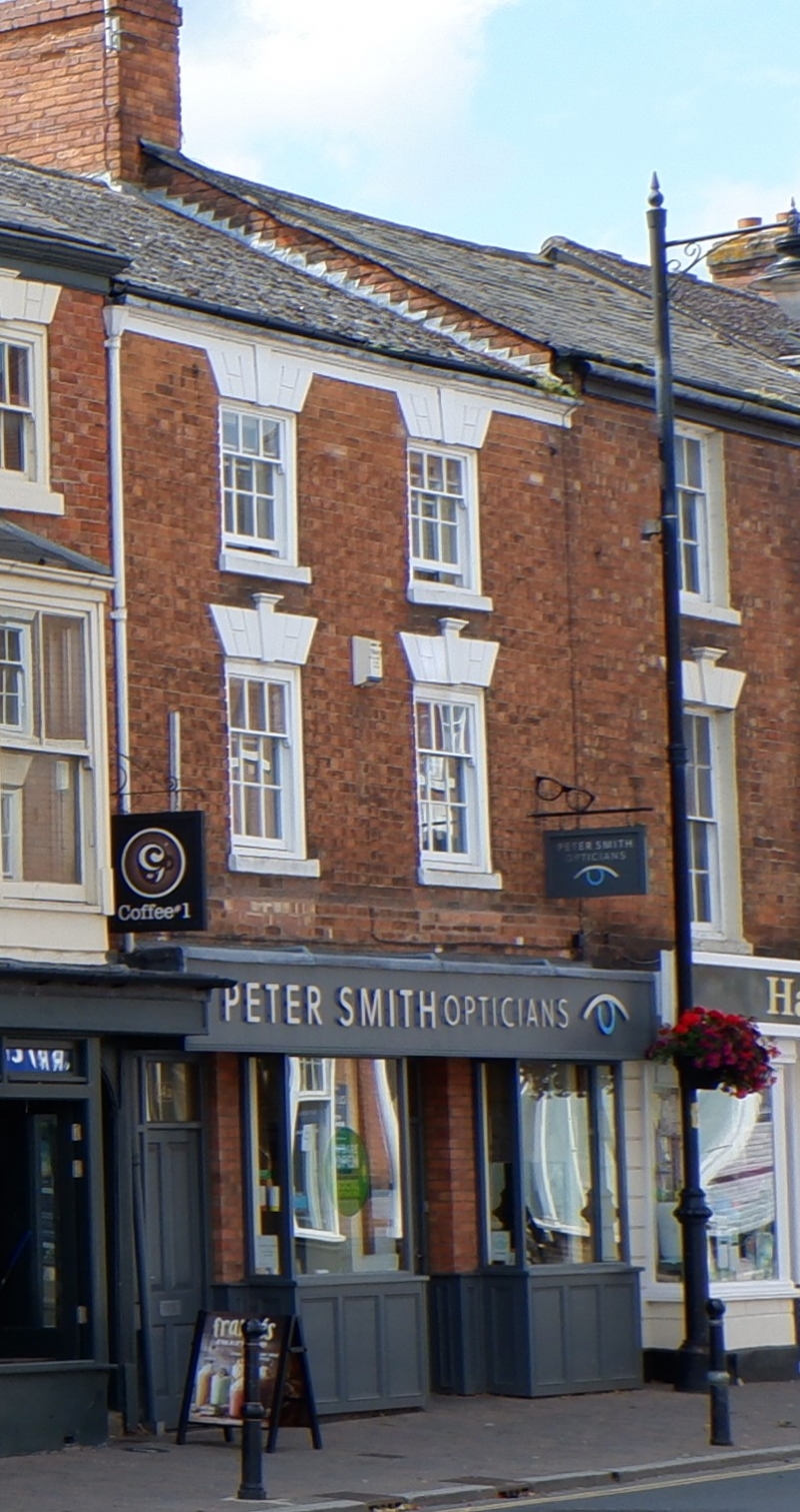
House, now shop and store. Late C18 with later alterations.
Red brick in Flemish bond. Welsh-slate roof with moulded
rendered eaves cornice and shared brick end-stack on right.
EXTERIOR: 3 storeys. 2-window range of 3/6 boxed sashes,
smaller on 2nd floor, all with painted channelled voussoirs,
keystones and sills. Ground floor: 2 plate-glazed canted
bay-windows with rounded corner mullions and architraves
incoporating tiled risers flanking central 3-panel glazed door
with overlight; deep fascia with blind fittings above.
INTERIOR: not inspected.
Listing NGR: SO9494645787
External links are from the relevant listing authority and, where applicable, Wikidata. Wikidata IDs may be related buildings as well as this specific building. If you want to add or update a link, you will need to do so by editing the Wikidata entry.


Other nearby listed buildings
