Latitude: 50.7852 / 50°47'6"N
Longitude: -1.0575 / 1°3'27"W
OS Eastings: 466534
OS Northings: 98824
OS Grid: SZ665988
Mapcode National: GBR VXC.MF
Mapcode Global: FRA 87N0.KV6
Plus Code: 9C2WQWPR+3X
Entry Name: Main Gate and Perimeter Walls, Marine Gate
Listing Date: 25 September 1972
Last Amended: 18 March 1999
Grade: II
Source: Historic England
Source ID: 1387089
English Heritage Legacy ID: 474505
ID on this website: 101387089
Location: Eastney, Portsmouth, Hampshire, PO4
County: City of Portsmouth
Electoral Ward/Division: Eastney and Craneswater
Parish: Non Civil Parish
Built-Up Area: Portsmouth
Traditional County: Hampshire
Lieutenancy Area (Ceremonial County): Hampshire
Church of England Parish: Milton St James
Church of England Diocese: Portsmouth
Tagged with: Architectural structure
PORTSMOUTH
SZ6698NE CROMWELL ROAD, Eastney 774-1/27/152 (East side) 25/09/72 Main Gate and perimeter walls, Marine Gate (Formerly Listed as: CROMWELL ROAD, Eastney Walls and main gate of Eastney Barracks facing Cromwell Road)
GV II
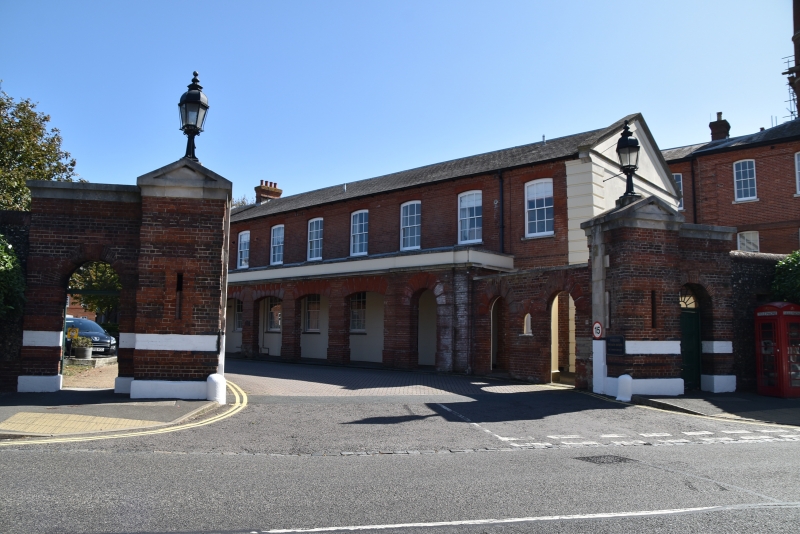
Main gate and defensible perimeter walls to RM Eastney Barracks. 1862-7, by William Scamp, for the Admiralty Works Department; converted 1995. Flint, red brick and ashlar. Walls define a rectangular plot, with main gate at mid-point in west wall, east wall broken by two C20 roads, and on south side only a short stretch of wall (approx 15 metres long) at either end terminating in a large square pier. Main gate has banded brick piers each with ashlar hanging style and frieze below pedimented capstone which supports large iron lamp standard with finialed rounded cap. To either side, brick wall has pedestrian archway; eaves frieze and plain cornice continued from pier; and outward pointing ashlar mortar. Rest of wall is of flint rubble with red brick bands, quoined pilaster strips and stepped rounded coping; horizontal gun apertures with stone lintels at approx 1 metre intervals. The terminating piers of south wall have quadrant steps up to a round archway on inner face; slits to north and south faces; band below massive, roll moulded stepped pyramidal capstone; and to the west pier a low screen wall, formerly surmounted by inward pointing ashlar mortar and pile of mortar balls (removed 1992). HISTORY: the walls formed the perimeter to the former Marines barracks, illustrating the defensible nature of the barracks. This is probably the last large defensible barracks built in the country, designed against an external threat, rather than for the more usual civil order duties. Part of the best and most complete barracks of the post-Crimean war period. (The Buildings of England: Pevsner N & Lloyd D: Hampshire and the Isle of Wight: Harmondsworth: 1967-: 429; PSA Drawings Collection, NMR, Swindon: 1862-1865: PTM/2275-2383).
Listing NGR: SZ6658898977
External links are from the relevant listing authority and, where applicable, Wikidata. Wikidata IDs may be related buildings as well as this specific building. If you want to add or update a link, you will need to do so by editing the Wikidata entry.


Other nearby listed buildings