Approximate Location Map
Large Map »
Latitude: 51.2702 / 51°16'12"N
Longitude: 0.524 / 0°31'26"E
OS Eastings: 576163
OS Northings: 155361
OS Grid: TQ761553
Mapcode National: GBR PR7.79D
Mapcode Global: VHJMF.1BBM
Plus Code: 9F327GCF+3H
Entry Name: East Boundary Wall Formerly to Digons
Listing Date: 11 May 1999
Grade: II
Source: Historic England
Source ID: 1387228
English Heritage Legacy ID: 475155
ID on this website: 101387228
Location: Maidstone, Kent, ME15
County: Kent
District: Maidstone
Town: Maidstone
Electoral Ward/Division: High Street
Parish: Non Civil Parish
Built-Up Area: Maidstone
Traditional County: Kent
Lieutenancy Area (Ceremonial County): Kent
Tagged with: Wall
TQ 7655 SW KNIGHTRIDER STREET
Maidstone
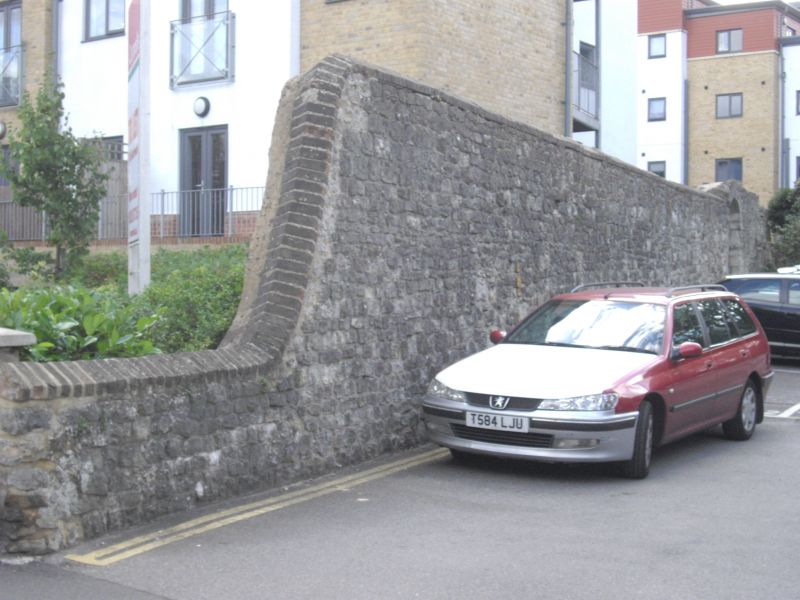
7/10013 East Boundary Wall
Formerly to Digons
GV II
Boundary wall. Mediaeval masonry with C19 parapet. Wall of Kentish ragstone random rubble about 8 feet in height with brick parapet, incorporating a blocked mediaeval two-centred arch within a later cambered arch. The top of the rear of the wall is of red brick. This was part of the eastern boundary wall of Digons, a house dating from the C13 which was demolished in 1964.
Listing NGR: TQ7616455362
External links are from the relevant listing authority and, where applicable, Wikidata. Wikidata IDs may be related buildings as well as this specific building. If you want to add or update a link, you will need to do so by editing the Wikidata entry.


Other nearby listed buildings
