Latitude: 51.8936 / 51°53'37"N
Longitude: -2.0802 / 2°4'48"W
OS Eastings: 394578
OS Northings: 221677
OS Grid: SO945216
Mapcode National: GBR 2MB.8WP
Mapcode Global: VH947.WNNQ
Plus Code: 9C3VVWV9+CW
Entry Name: Number 55 and Attached Railings
Listing Date: 14 December 1983
Grade: II
Source: Historic England
Source ID: 1387331
English Heritage Legacy ID: 475286
ID on this website: 101387331
Location: Montpellier, Cheltenham, Gloucestershire, GL50
County: Gloucestershire
District: Cheltenham
Electoral Ward/Division: Lansdown
Parish: Non Civil Parish
Built-Up Area: Cheltenham
Traditional County: Gloucestershire
Lieutenancy Area (Ceremonial County): Gloucestershire
Church of England Parish: Leckhampton St Philip and St James
Church of England Diocese: Gloucester
Tagged with: Building
CHELTENHAM
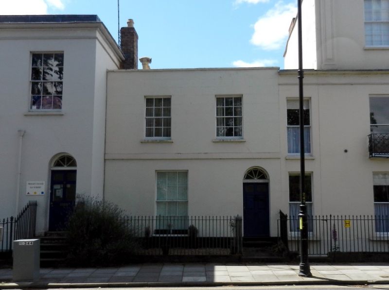
SO9421NE MONTPELLIER TERRACE 630-1/18/551 (South side) 14/12/83 No.55 and attached railings
GV II
Terraced house and attached railings. c1820-34, shown on Merrett's 1834 Map but not on the Post Office Map of 1820. Stucco over brick with concealed roof, tall brick stacks to left. EXTERIOR: 2 storeys, 2 first-floor windows. First-floor band. 6/6 sashes throughout, taller to ground floor. Right end entrance a part-glazed 6-fielded-panel door with lattice frieze and fanlight with radial glazing bars. Low parapet with copings. INTERIOR: not inspected. SUBSIDIARY FEATURES: lancet railings and urn finials abut at right. (The Buildings of England: Verey D: Gloucestershire: The Vale and The Forest of Dean: London: 1970-: 143; Merrett HS: Plan of the Town of Cheltenham: 1834-).
Listing NGR: SO9457821677
External links are from the relevant listing authority and, where applicable, Wikidata. Wikidata IDs may be related buildings as well as this specific building. If you want to add or update a link, you will need to do so by editing the Wikidata entry.


Other nearby listed buildings