Latitude: 53.2606 / 53°15'38"N
Longitude: -3.0256 / 3°1'32"W
OS Eastings: 331684
OS Northings: 374225
OS Grid: SJ316742
Mapcode National: GBR 7Z9Q.RW
Mapcode Global: WH87Z.H9GP
Plus Code: 9C5R7X6F+6Q
Entry Name: Elm Farmhouse
Listing Date: 22 March 1974
Grade: II
Source: Historic England
Source ID: 1387719
English Heritage Legacy ID: 475706
ID on this website: 101387719
Location: Cheshire West and Chester, Cheshire, CH64
County: Cheshire West and Chester
Electoral Ward/Division: Little Neston and Burton
Parish: Non Civil Parish
Built-Up Area: Burton
Traditional County: Cheshire
Lieutenancy Area (Ceremonial County): Cheshire
Church of England Parish: Burton St Nicholas
Church of England Diocese: Chester
Tagged with: Farmhouse
NESTON
SJ3174 PUDDINGTON LANE, Burton Village 794-1/11/5 Elm Farmhouse 22/03/74
GV II
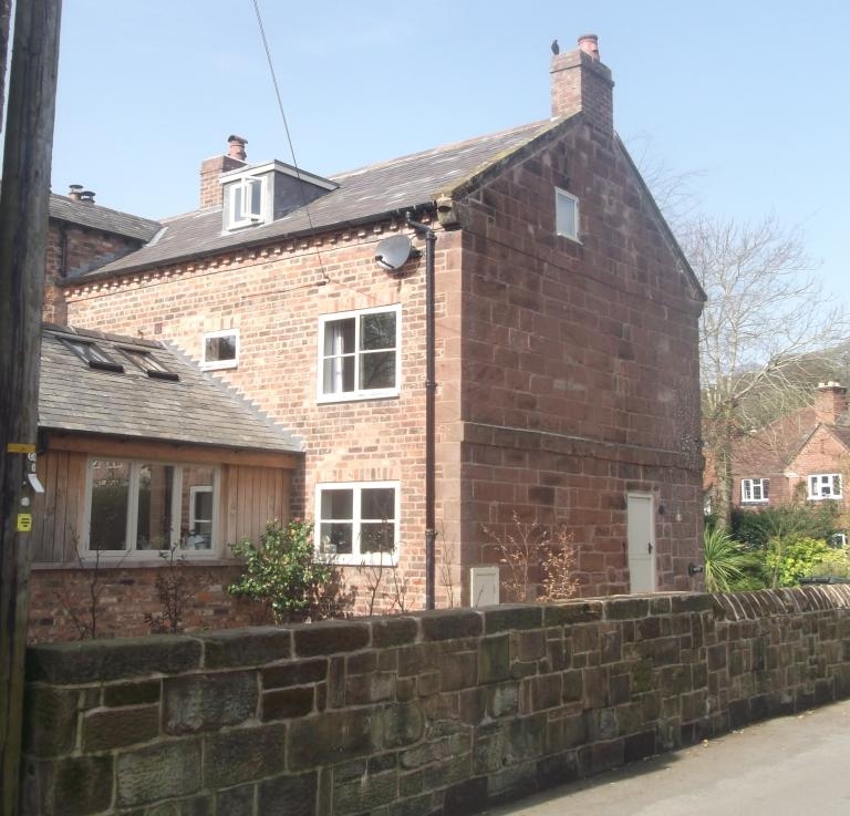
Farmhouse, now private house. C17 with substantial remodelling in C19 and C20 addition. Stone and brown brick with stone plinth and first floor band, and flush quoins; slate roof with 3 stacks. EXTERIOR: 2 storeys and attic; 3-bay front with added bay to right. Replacement boarded door fronted by C20 2-column porch with flat hood. Two and three light replacement flush casements, these at ground floor with transom. Dentil eaves course. INTERIOR: inglenook with curved firebeam. Chamfered ceiling beams and exposed joists. Former baffle entry plan form suggested by the position of the fireplace and stone wing wall.
Listing NGR: SJ3168474225
External links are from the relevant listing authority and, where applicable, Wikidata. Wikidata IDs may be related buildings as well as this specific building. If you want to add or update a link, you will need to do so by editing the Wikidata entry.


Other nearby listed buildings