Latitude: 53.6053 / 53°36'18"N
Longitude: -2.4229 / 2°25'22"W
OS Eastings: 372110
OS Northings: 412160
OS Grid: SD721121
Mapcode National: GBR CVJR.7B
Mapcode Global: WH97N.RND0
Plus Code: 9C5VJH4G+4R
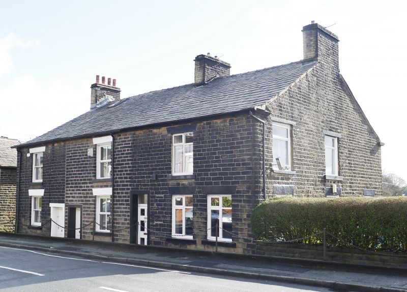
Entry Name: 230, 232 and 234, Ashworth Lane
Listing Date: 26 April 1974
Grade: II
Source: Historic England
Source ID: 1387862
English Heritage Legacy ID: 475854
ID on this website: 101387862
Location: Astley Bridge, Bolton, Greater Manchester, BL1
County: Bolton
Electoral Ward/Division: Astley Bridge
Parish: Non Civil Parish
Built-Up Area: Bolton
Traditional County: Lancashire
Lieutenancy Area (Ceremonial County): Greater Manchester
Church of England Parish: Astley Bridge St Paul
Church of England Diocese: Manchester
Tagged with: Building
BOLTON
SD7212SW ASHWORTH LANE 797-1/6/4 (South side) 26/04/74 Nos.230, 232 AND 234
GV II
Terrace of 3 houses. c1835-1850. Squared and watershot coursed stone with slate roof. EXTERIOR AND PLAN: 2 storeys, 3-window range, comprising 3 single unit, double pile plan dwellings, built in 2 phases. Doorways with plain architraves of painted stone, and 4-pane sashes to No.234, altered glazing to Nos 230 & 232; windows with wedge lintels. Ridge chimney and gable chimneys. INTERIOR: not inspected. The terrace forms part of the model factory community established by the Ashworth family of New Eagley Mill between 1835 and 1855 (Ashworth Lane, Eleanor Street, Hugh Lupus Street, qv). (Boyson R: The Ashworth Cotton Enterprise: Oxford: 1970-; Smalley PJ: A Study of Model Villages (Manchester Polytechnic dissertation): 1983-).
Listing NGR: SD7211012160
External links are from the relevant listing authority and, where applicable, Wikidata. Wikidata IDs may be related buildings as well as this specific building. If you want to add or update a link, you will need to do so by editing the Wikidata entry.


Other nearby listed buildings