Latitude: 51.8887 / 51°53'19"N
Longitude: -2.0694 / 2°4'9"W
OS Eastings: 395318
OS Northings: 221126
OS Grid: SO953211
Mapcode National: GBR 2MB.KMK
Mapcode Global: VHB1Q.2STJ
Plus Code: 9C3VVWQJ+F6
Entry Name: West Entrance (To Left) with Boundary Walls and Pier to Thirlestaine Hall
Listing Date: 26 November 1998
Grade: II
Source: Historic England
Source ID: 1388143
English Heritage Legacy ID: 476141
ID on this website: 101388143
Location: Naunton Park, Cheltenham, Gloucestershire, GL53
County: Gloucestershire
District: Cheltenham
Electoral Ward/Division: College
Parish: Non Civil Parish
Built-Up Area: Cheltenham
Traditional County: Gloucestershire
Lieutenancy Area (Ceremonial County): Gloucestershire
Church of England Parish: Cheltenham St Luke and St John
Church of England Diocese: Gloucester
Tagged with: Building
CHELTENHAM
SO9521SW THIRLESTAINE ROAD 630-1/24/946 (North side) West entrance (to left) with boundary walls and pier to Thirlestaine Hall
GV II
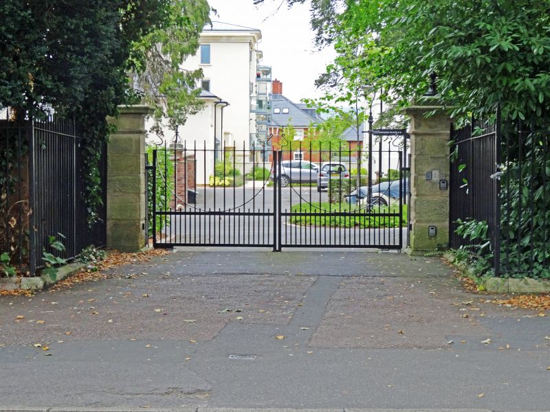
Pair of drive piers with C20 gates, quadrant walls to further pair of piers and with boundary wall and corner pier to left. c1855-7. Generally L-plan. Coursed stone walls and vermiculated ashlar piers with chamfered plinths, frieze, shaped cornice and caps and low quadrant walls to similar piers. Then coped wall to left (west) approx 2m high and 12m long, ramped upwards to similar corner pier. Wall returns to left boundary for approx 30m. A significant streetscape feature and part of the setting for Thirlestaine Hall (qv). Also groups with Main entrance at Thirlestaine Hall (qv) and Boundary walls with corner piers and gates to Thirlestaine Hall (qv), Thirlestaine Road.
Listing NGR: SO9531821126
External links are from the relevant listing authority and, where applicable, Wikidata. Wikidata IDs may be related buildings as well as this specific building. If you want to add or update a link, you will need to do so by editing the Wikidata entry.


Other nearby listed buildings