Latitude: 51.8874 / 51°53'14"N
Longitude: -2.085 / 2°5'5"W
OS Eastings: 394248
OS Northings: 220983
OS Grid: SO942209
Mapcode National: GBR 2MB.MP3
Mapcode Global: VH947.TT3H
Plus Code: 9C3VVWP8+X2
Entry Name: Hilgay Lodge and Attached Area Railings
Listing Date: 14 December 1983
Grade: II
Source: Historic England
Source ID: 1388168
English Heritage Legacy ID: 476166
ID on this website: 101388168
Location: The Park, Cheltenham, Gloucestershire, GL50
County: Gloucestershire
District: Cheltenham
Electoral Ward/Division: Park
Parish: Non Civil Parish
Built-Up Area: Cheltenham
Traditional County: Gloucestershire
Lieutenancy Area (Ceremonial County): Gloucestershire
Church of England Parish: Leckhampton St Philip and St James
Church of England Diocese: Gloucester
Tagged with: Architectural structure
CHELTENHAM
SO9420NW TUDOR LODGE ROAD 630-1/26/972 Hilgay Lodge and attached area 14/12/83 railings
GV II
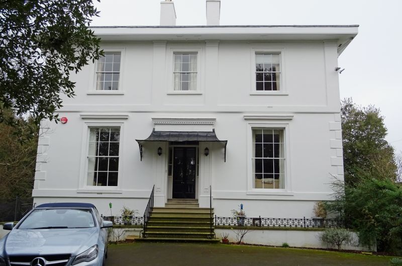
Villa. c1834-40 with later additions and alterations including C20 range to rear. Stucco over brick with hipped slate roof and 2 tall stucco ridge stacks and rear stack; iron area railings and brackets. Double-depth plan with central hallway and full-height service range to rear at left, with further addition to its rear. EXTERIOR: stucco detailing includes ground-floor band; quoins to ground-floor angles; first-floor band surmounted by pilasters to ends and to sides of central window; tooled architraves throughout with frieze and cornice to ground floor. 6/6 sashes throughout, those to ground floor are taller, all in plain reveals and with sills and tooled architraves, those to ground floor have cornices, those to first floor have plain aprons and frieze. Basement retains 6/6 sashes. Flight of 8 roll-edged steps to central entrance, panelled pilasters with frieze and dentil cornice, within are double part-glazed doors with margin-lights and overlight. Rear and return retain 6/6 and 8/8 sashes. INTERIOR: not inspected. SUBSIDIARY FEATURES: area railings have circle motif. Brackets to tent-roofed hood to entrance and to ground-floor window of right return. HISTORICAL NOTE: The house is set in oval plan grounds and is shown as laid out on Merrett's Map of 1834. Part of The Park development laid out for Thomas Billings in 1833; the estate was bought c1839 by architect SW Daukes, by which time most houses had been built. (The Buildings of England: Verey D: Gloucestershire: The Vale and The Forest of Dean: London: 1970-: 153).
Listing NGR: SO9424620984
External links are from the relevant listing authority and, where applicable, Wikidata. Wikidata IDs may be related buildings as well as this specific building. If you want to add or update a link, you will need to do so by editing the Wikidata entry.


Other nearby listed buildings