Latitude: 53.3056 / 53°18'20"N
Longitude: -2.3747 / 2°22'28"W
OS Eastings: 375129
OS Northings: 378806
OS Grid: SJ751788
Mapcode National: GBR CZV6.PR
Mapcode Global: WH997.H5FP
Plus Code: 9C5V8J4G+64
Entry Name: 2a-8, Minshull Street
Listing Date: 5 November 1990
Grade: II
Source: Historic England
Source ID: 1388411
English Heritage Legacy ID: 476422
ID on this website: 101388411
Location: Knutsford, Cheshire East, Cheshire, WA16
County: Cheshire East
Civil Parish: Knutsford
Built-Up Area: Knutsford
Traditional County: Cheshire
Lieutenancy Area (Ceremonial County): Cheshire
Church of England Parish: Knutsford St John the Baptist
Church of England Diocese: Chester
Tagged with: Building
This list entry was subject to a Minor Amendment on 1 May 2024 to update the name and address and to reformat the text to current standards
SJ7478
792-1/3/90
KNUTSFORD
MINSHULL STREET (north side)
Nos.2a-8 (even)
(Formerly listed as Nos.2-8 (Even))
05/11/90
GV
II
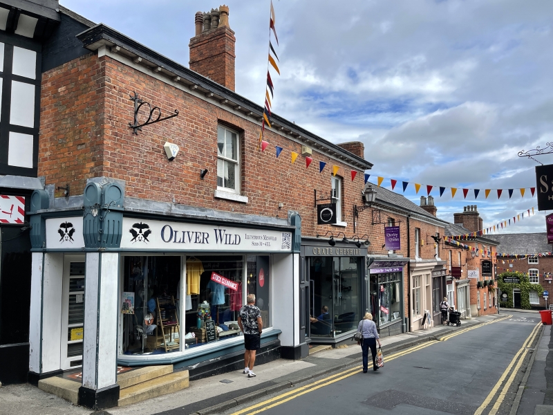
Row of four shops. Early C19. Brick with Welsh slate roof. Two storeys, each a two window range, the terrace stepped in profile down the slope. Shop fronts removed for refurbishment at time of survey, the upper windows four-pane sashes with flat-arched gauged brick heads.
INTERIOR: not inspected.
Listing NGR: SJ 75129 78806
External links are from the relevant listing authority and, where applicable, Wikidata. Wikidata IDs may be related buildings as well as this specific building. If you want to add or update a link, you will need to do so by editing the Wikidata entry.


Other nearby listed buildings