Latitude: 52.2151 / 52°12'54"N
Longitude: -2.2206 / 2°13'14"W
OS Eastings: 385024
OS Northings: 257450
OS Grid: SO850574
Mapcode National: GBR 1FY.3DM
Mapcode Global: VH92M.GLF9
Plus Code: 9C4V6Q8H+2Q
Entry Name: North Gate Pier, Quadrant Wall, Railings and Pier at Entrance to Perdiswell Park
Listing Date: 22 May 1954
Last Amended: 27 June 2001
Grade: II
Source: Historic England
Source ID: 1389772
English Heritage Legacy ID: 488723
ID on this website: 101389772
Location: Barbourne, Worcester, Worcestershire, WR3
County: Worcestershire
District: Worcester
Electoral Ward/Division: Claines
Parish: Non Civil Parish
Built-Up Area: Worcester
Traditional County: Worcestershire
Lieutenancy Area (Ceremonial County): Worcestershire
Church of England Parish: Claines
Church of England Diocese: Worcester
Tagged with: Building
WORCESTER
SO85NE DROITWICH ROAD
620-1/2/216 (East side)
22/05/54 North gate pier,
quadrant wall, railings
and pier at entrance to
Perdiswell Park
(Formerly Listed as:
PERDISWELL PARK
Stable block of former
Perdiswell Hall, Gate
piers at drive entrance)
GV II
Formerly known as: Coach House.
Includes: North gatepier, quadrant wall, railings and pier at
entrance PERDISWELL PARK.
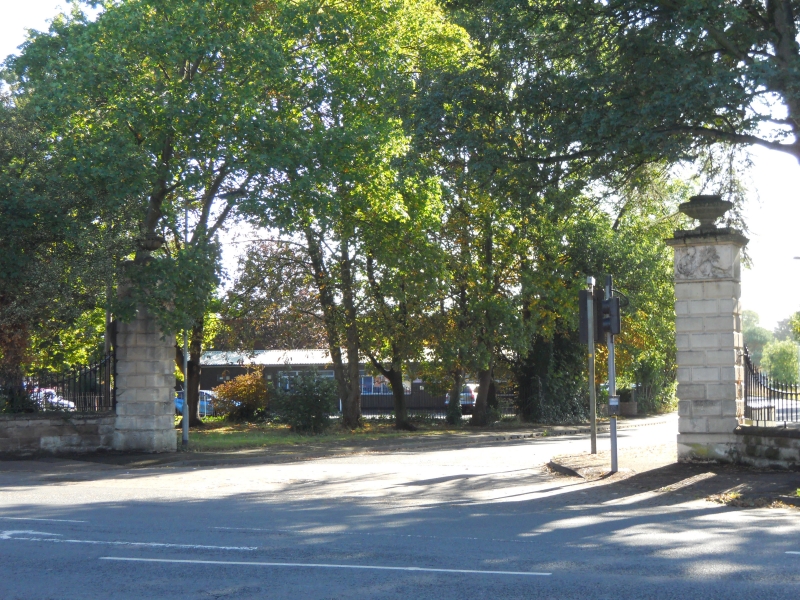
Gate pier, quadrant wall with railings and end pier. Gatepier
dated 1788 to frieze, with quadrant walls, pier and railings
probably c1880. Rusticated ashlar pier approximately 3.5
metres high with Coade stone panel to frieze and surmounting
urn. Frieze shows reclining female with tall ship and chart
figure representing 'Navigation' and is inscribed 'COADE'S
Lithod-y- LONDON 1788'. Rough coursed stone quadrant walls
approximately 1 metre igh with curved ashlar copings and
cast-iron railings with round-arched arcade and spearhead
bars, extending for approximately 12 metres to rough coursed
stone end pier with peaked cap approximately 2 metres high.
HISTORICAL NOTE: forms the entrance to the former Perdiswell
Hall (demolished 1956), and now to Perdiswell Park together
with South gate pier, quadrant wall, railings and pier (qv).
The Stable Block and walled garden of former Perdiswell Hall
remain (qv).
Pevsner describes the Coade stone reliefs as 'beautiful'.
(The Buildings of England: Pevsner: N: Worcestershire:
Harmondsworth: 1968-1985: 335; NMR: Photographs).
External links are from the relevant listing authority and, where applicable, Wikidata. Wikidata IDs may be related buildings as well as this specific building. If you want to add or update a link, you will need to do so by editing the Wikidata entry.


Other nearby listed buildings