Approximate Location Map
Large Map »
Latitude: 51.3828 / 51°22'57"N
Longitude: -2.3484 / 2°20'54"W
OS Eastings: 375851
OS Northings: 164914
OS Grid: ST758649
Mapcode National: GBR 0QJ.73L
Mapcode Global: VH96M.7HVT
Plus Code: 9C3V9MM2+4J
Entry Name: Walls and Gateways to Miles House
Listing Date: 5 August 1975
Last Amended: 15 October 2010
Grade: II
Source: Historic England
Source ID: 1394275
English Heritage Legacy ID: 509678
ID on this website: 101394275
Location: Bathwick, Bath and North East Somerset, Somerset, BA2
County: Bath and North East Somerset
Parish: Non Civil Parish
Built-Up Area: Bath
Traditional County: Somerset
Lieutenancy Area (Ceremonial County): Somerset
Tagged with: Wall
BATHWICK HILL
(North side)
Walls and gateways to Miles House
(Formerly Listed as: BATHWICK STREET
(North side) Wall and Gateway to
Miles House along road)
05/08/75
GV II
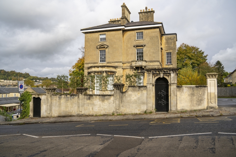
Walls with gateways to the front and enclosing the grounds of Miles House (qv). c1840. Possibly by H.E. Goodridge.
MATERIALS: Limestone ashlar.
EXTERIOR: The front wall with plain coping, sloping uphill to the right for approx. 90m, is approx. 2m high, articulated at irregular intervals by six substantial piers approx 2.5m high. The shafts have raised panels with ogees to top and base within recessed panels, the cornices have modillions on lintels and the caps have chamfered edges and flat tops. To the left, below the coping, is a shouldered arch with a keystone over a C20 planked door; to the left-of-centre wall sweeps up to meet a semicircular arch with moulded imposts and a cornice similar to those of the piers over a pedestrian door; to the right are piers flanking a carriage entrance with C20 double gates, the wall to the far right is higher with a terminal pier. The garden to the sides and rear, approx. 90m square, is enclosed by a rough ashlar wall approx. 2m high.
HISTORY: A particularly imposing sequence of wall, piers and gateways, the design of which strongly suggests that H.E. Goodridge was involved in its design.
Listing NGR: ST7585164914
External links are from the relevant listing authority and, where applicable, Wikidata. Wikidata IDs may be related buildings as well as this specific building. If you want to add or update a link, you will need to do so by editing the Wikidata entry.


Other nearby listed buildings
