Approximate Location Map
Large Map »
Latitude: 51.3794 / 51°22'45"N
Longitude: -2.3611 / 2°21'40"W
OS Eastings: 374961
OS Northings: 164540
OS Grid: ST749645
Mapcode National: GBR 0QH.HVR
Mapcode Global: VH96M.1L3F
Plus Code: 9C3V9JHQ+PG
Entry Name: 6-18, St James's Parade
Listing Date: 12 June 1950
Last Amended: 15 October 2010
Grade: II
Source: Historic England
Source ID: 1394829
English Heritage Legacy ID: 510236
ID on this website: 101394829
Location: Bath, Bath and North East Somerset, Somerset, BA1
County: Bath and North East Somerset
Parish: Non Civil Parish
Built-Up Area: Bath
Traditional County: Somerset
Lieutenancy Area (Ceremonial County): Somerset
Church of England Parish: Bath St Michael Without
Church of England Diocese: Bath and Wells
Tagged with: Building
656-1/18/117
12.6.50
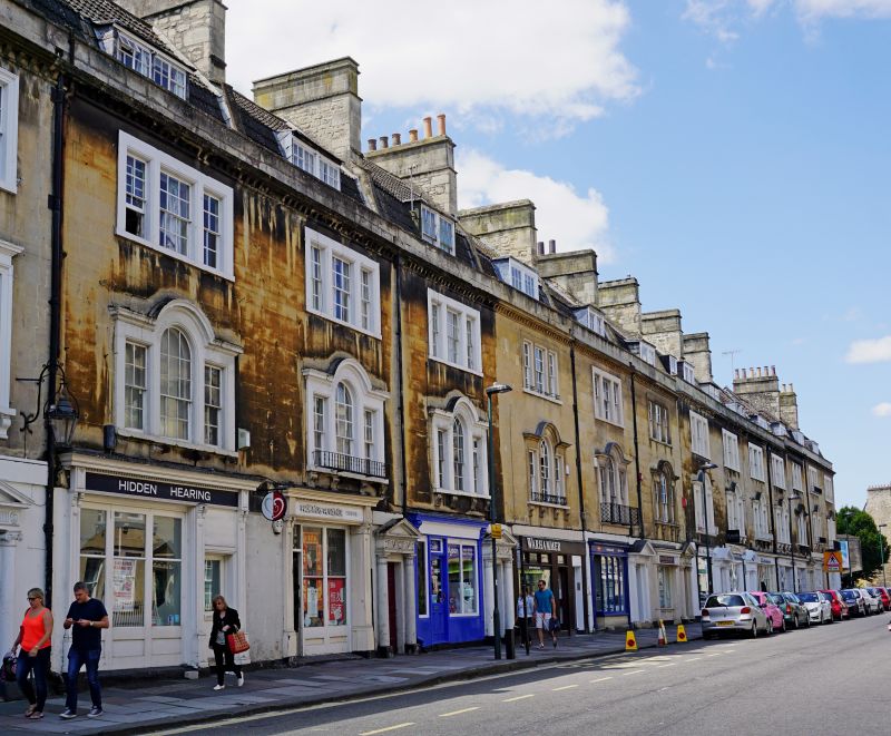
ST JAMES'S PARADE
(South West Side)
Nos 6 to 18 (consec)
(Formerly listed as ST JAMES'S PARADE,
6 to 18 consec & No 19 (Devonshire Arms Public House)
II
Terrace of houses and shops. c1768. Probably John Palmer, architect but possibly Wood the Younger, who also used Venetian windows motif but with more refinement.
MATERIALS: Limestone ashlar, rubble in part to rear, slate and double Roman tile roof. Three storeys plus mansard.
EXTERIOR: First floor Venetian windows (all except No 19). Three-light window above. Doorways. with Doric order and pediments; some carved triglyphs and metopes with rosettes or swags.
INTERIOR: Not inspected.
HISTORY: St James's Parade, originally Thomas Street, was the centrepiece of a development from 1765 onwards by Richard Jones, Thomas Jelly and Henry Fisher who were granted liberty in September 1765 to 'pull down the Boro' walls next to the Ambry gardens in order to build new houses there'. The street was closed off with bollards at each end, and the houses fronted a broad paved walk in place of the road. The elevations, attributed to Thomas Jelly and John Palmer, show the influence of John Wood the Younger's work elsewhere, as in Rivers Street. The houses were mainly built in c1768. Following bomb damage in the area, extensive clearance and redevelopment has taken place. St James's Parade, after an uncertain period, was reprieved. This pub was formerly known as the Rugby Arms.
SOURCES: W. Ison 'The Georgian Buildings of Bath' (1980 ed), 151; Bath City Council planning file.
Listing NGR: ST7496164540
External links are from the relevant listing authority and, where applicable, Wikidata. Wikidata IDs may be related buildings as well as this specific building. If you want to add or update a link, you will need to do so by editing the Wikidata entry.


Other nearby listed buildings
