Approximate Location Map
Large Map »
Latitude: 52.6771 / 52°40'37"N
Longitude: -2.5482 / 2°32'53"W
OS Eastings: 363029
OS Northings: 308962
OS Grid: SJ630089
Mapcode National: GBR BS.4KC4
Mapcode Global: WH9D1.TZR1
Plus Code: 9C4VMFG2+RP
Entry Name: Wrekin Rifle Range Target Gallery
Listing Date: 31 October 2017
Grade: II
Source: Historic England
Source ID: 1445567
ID on this website: 101445567
Location: Telford and Wrekin, Shropshire, TF6
County: Telford and Wrekin
Civil Parish: Wrockwardine
Traditional County: Shropshire
Lieutenancy Area (Ceremonial County): Shropshire
Tagged with: Architectural structure
A rifle range, dating from the later C19 and possibly earlier, in use until the second half of the C20.
A rifle range target gallery, dating from the early C20.
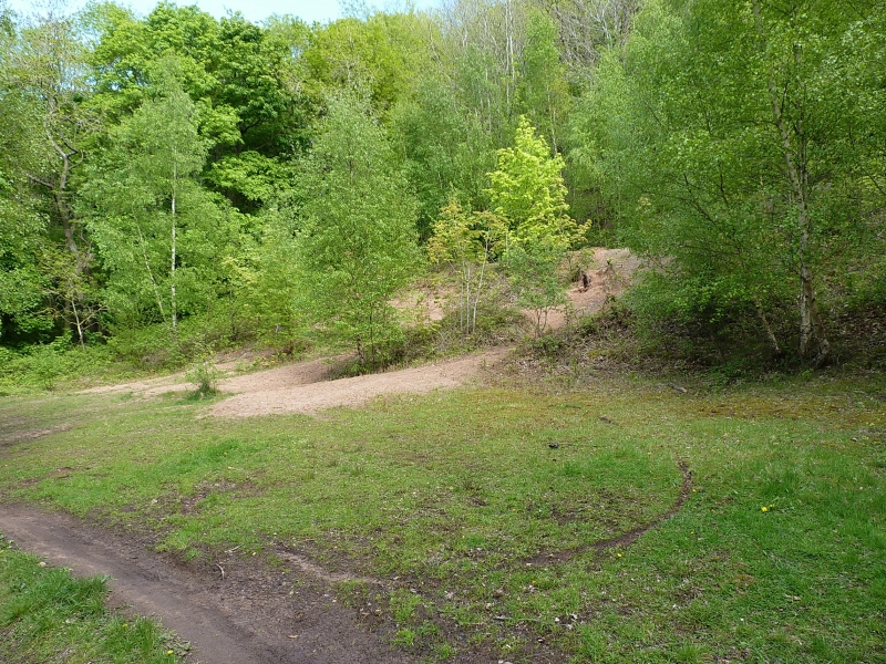
MATERIALS & PLAN: the target gallery forms part of a rifle range which is roughly rectangular, approached from the road at its northern end. The target gallery is set at the south-eastern end behind a raised martlet. The rear wall of the target gallery and the walls surrounding the target emplacement and trench are of brick, laid in English bond and Garden Wall bond with glazed, shaped capping bricks. Supports and the target frames are of iron, apparently originally painted blue.
The target end has a high martlet of earth with square timber baulks to its north-western (firing) side, which may originally have been covered by earth. Behind this the firing gallery has twelve iron target frames of the Hythe pattern, which retain some patches of their original blue paint, and which are set in a continuous frame trench. Iron brackets and T-shaped posts support the concrete gallery roof. The rear wall of the target gallery is of Garden Wall bond at its south-western end and English bond at the north-eastern end, which may mark the extension of the gallery at some time after the 1928 OS map was surveyed. Steps lead down from the gallery at its north-eastern end to a corrugated iron target store. The rear wall turns at right angles to face south-east at each end of the gallery and square timbers are set vertically above these flank walls to form a screen. Further to the south east is a sand bank which forms a stop butt and follows the rise of the hillside.
The range, which was initially used by the King's Shropshire Light Infantry, contracted in length during its period of use. It was latterly confined to the area south-east of the roadway known as Wrekin Course and was a 300 yard range. Previously it straddled the road and is shown on the map published by HMSO in 1966 (see SOURCES) as extending to 600 yards and the Ordnance Survey (OS) maps of 1889 and 1903 as extending to 900 yards.
The OS map of 1889 shows targets (plural) in the same place as the present target gallery. The 1902 map shows a line of targets which is roughly half the extent of the present target gallery, at its south-western end and this is also shown on the OS map of 1928, which also appears to show a shorter version of the present gallery arrangement. It seems likely that the present extent of the target gallery, with 12 frames, resulted from the period before the Second World War.
The King's Shropshire Light Infantry was formed in 1881 in response to the Childers army reforms of that year. The regiment served in the Anglo-Egyptian War, the Second Boer War and both World Wars. The site is also recorded as being used by the Shropshire Yeomanry and the Home Guard during the Second World War. In 1968 they were merged with other regiments to form The Light Infantry.
Byelaws for the range were published in May 1966 for use from September of that year.
The range was used by the Wrekin Rifle Club from the 1960s, but it is not now in use. A public footpath crosses between the target gallery and the sand butt.
The rifle range target gallery at Wrekin Rifle Range, built around 1902 and extended in about 1928, is listed at Grade II for the following principal reasons:
Architectural interest:
* As a functional building which was soundly and logically planned and built;
* The structural integrity of the target gallery and associated target frames, along with its contemporary setting.
Historic interest:
* As a representative and significant example of a rifle range target gallery, built for an infantry regiment and subsequently adapted in the very early C20 and used for training in both world wars;
* An important landscape feature which acts as a poignant reminder of the character and provision of local military training for the King's Shropshire Light Infantry and successive regiments.
Group value:
* The target gallery is a constituent part of the Wrekin Rifle Range which is itself a Scheduled Ancient Monument (NHLE 1445909).
External links are from the relevant listing authority and, where applicable, Wikidata. Wikidata IDs may be related buildings as well as this specific building. If you want to add or update a link, you will need to do so by editing the Wikidata entry.


Other nearby listed buildings