Approximate Location Map
Large Map »
Latitude: 57.3216 / 57°19'17"N
Longitude: -3.606 / 3°36'21"W
OS Eastings: 303380
OS Northings: 826810
OS Grid: NJ033268
Mapcode National: GBR K9GC.NWG
Mapcode Global: WH5JP.L71J
Plus Code: 9C9R89CV+JH
Entry Name: New Spey Bridge
Listing Name: (New) Spey Bridge over River Spey
Listing Date: 26 January 1971
Category: B
Source: Historic Scotland
Source ID: 330556
Historic Scotland Designation Reference: LB336
Building Class: Cultural
ID on this website: 200330556
Location: Cromdale, Inverallan and Advie
County: Highland
Electoral Ward: Badenoch and Strathspey
Parish: Cromdale, Inverallan And Advie
Traditional County: Morayshire
Tagged with: Bridge
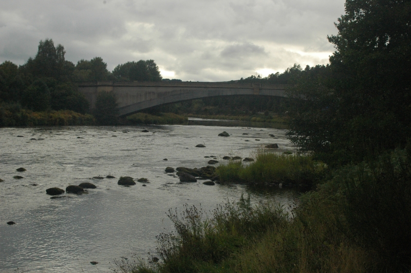
Dated 1931, Blythe and Blyth, engineers. Elegant single
span concrete bridge; shallow segmental arch ring flanked
at each bank by heavy polygonal buttresses rising from
battered bases. End round-headed pedestrian/flood arches;
concrete parapet; centre plaque.
Span; 240' (73.2m).
River Spey forms boundary with Abernethy and Kincardine
Parish.
External links are from the relevant listing authority and, where applicable, Wikidata. Wikidata IDs may be related buildings as well as this specific building. If you want to add or update a link, you will need to do so by editing the Wikidata entry.


Other nearby listed buildings
