Approximate Location Map
Large Map »
Latitude: 55.9468 / 55°56'48"N
Longitude: -3.5086 / 3°30'30"W
OS Eastings: 305882
OS Northings: 673663
OS Grid: NT058736
Mapcode National: GBR 1W.Y9QT
Mapcode Global: WH5RB.2SJH
Plus Code: 9C7RWFWR+PH
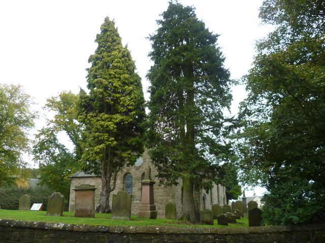
Entry Name: Ecclesmachan Parish Church
Listing Name: Ecclesmachan Kirk (St. Machan's)
Listing Date: 22 February 1971
Category: B
Source: Historic Scotland
Source ID: 331041
Historic Scotland Designation Reference: LB656
Building Class: Cultural
ID on this website: 200331041
Location: Ecclesmachan
County: West Lothian
Electoral Ward: Broxburn, Uphall and Winchburgh
Parish: Ecclesmachan
Traditional County: West Lothian
Tagged with: Church building
Mediaeval but much altered in 1710, 1822, 1908. Oblong. Coursed rubble. Skew-gables. Slated roof. Round-headed windows. Norman doorway. N. aisle (dated 1710) extended E. and W. in 1908 and porch added. Chancel and vestry added to W. end in 1908. Plain interior: re-cast in 1822 and 1908.
In ecclesiastical use
External links are from the relevant listing authority and, where applicable, Wikidata. Wikidata IDs may be related buildings as well as this specific building. If you want to add or update a link, you will need to do so by editing the Wikidata entry.


Other nearby listed buildings
