Latitude: 55.7051 / 55°42'18"N
Longitude: -3.8662 / 3°51'58"W
OS Eastings: 282828
OS Northings: 647312
OS Grid: NS828473
Mapcode National: GBR 12FG.SQ
Mapcode Global: WH4R5.LV5T
Plus Code: 9C7RP44M+2G
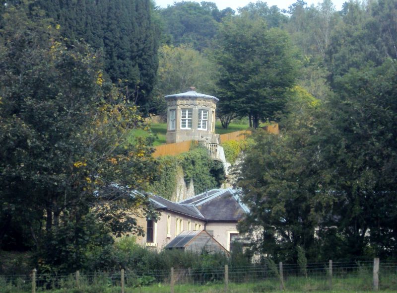
Entry Name: Gazebo, Orchard House
Listing Name: Pavilion, Orchard House
Listing Date: 12 January 1971
Category: B
Source: Historic Scotland
Source ID: 331130
Historic Scotland Designation Reference: LB725
Building Class: Cultural
Also known as: Orchard House, Gazebo
ID on this website: 200331130
Location: Carluke
County: South Lanarkshire
Electoral Ward: Clydesdale West
Parish: Carluke
Traditional County: Lanarkshire
Tagged with: Architectural structure
Octagonal, Doric friese. Early 19th century.
External links are from the relevant listing authority and, where applicable, Wikidata. Wikidata IDs may be related buildings as well as this specific building. If you want to add or update a link, you will need to do so by editing the Wikidata entry.


Other nearby listed buildings