Approximate Location Map
Large Map »
Latitude: 55.1045 / 55°6'16"N
Longitude: -5.0098 / 5°0'35"W
OS Eastings: 208088
OS Northings: 583033
OS Grid: NX080830
Mapcode National: GBR GH06.V9L
Mapcode Global: WH2R8.0YNQ
Plus Code: 9C7P4X3R+Q3
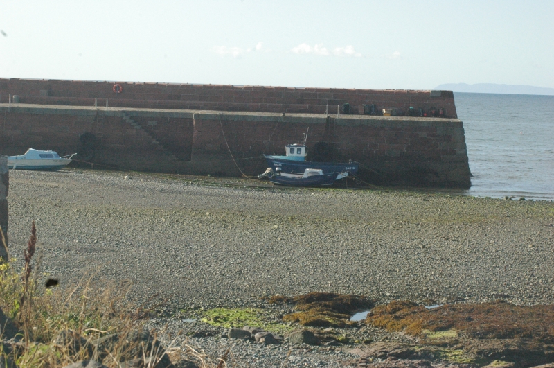
Entry Name: Harbour Pier, Ballantrae
Listing Name: Harbour Pier
Listing Date: 14 April 1971
Category: B
Source: Historic Scotland
Source ID: 331314
Historic Scotland Designation Reference: LB872
Building Class: Cultural
Also known as: Ballantrae, Harbour Pier
ID on this website: 200331314
Location: Ballantrae
County: South Ayrshire
Electoral Ward: Girvan and South Carrick
Parish: Ballantrae
Traditional County: Ayrshire
Tagged with: Architectural structure
Built with dressed sandstone. Improvements carried out in
about 1860
External links are from the relevant listing authority and, where applicable, Wikidata. Wikidata IDs may be related buildings as well as this specific building. If you want to add or update a link, you will need to do so by editing the Wikidata entry.


Other nearby listed buildings
