Approximate Location Map
Large Map »
Latitude: 55.7469 / 55°44'48"N
Longitude: -4.2552 / 4°15'18"W
OS Eastings: 258535
OS Northings: 652692
OS Grid: NS585526
Mapcode National: GBR 3R.BZSB
Mapcode Global: WH3PN.LTX7
Plus Code: 9C7QPPWV+QW
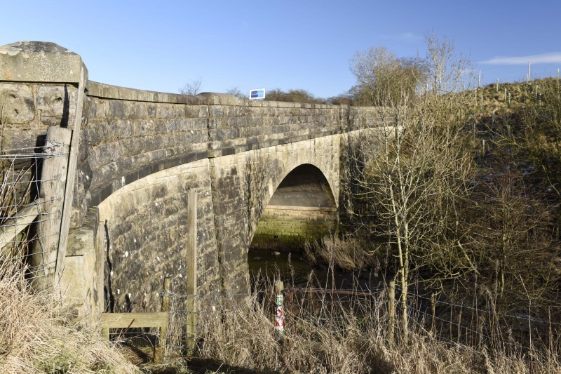
Entry Name: Kirkland Bridge, White Cart Water, Eaglesham Road, Eaglesham
Listing Name: Kirkland Bridge
Listing Date: 20 February 1979
Category: C
Source: Historic Scotland
Source ID: 331471
Historic Scotland Designation Reference: LB1010
Building Class: Cultural
ID on this website: 200331471
Location: East Kilbride
County: South Lanarkshire
Electoral Ward: Newton Mearns South and Eaglesham
Parish: East Kilbride
Traditional County: Renfrewshire
Tagged with: Bridge
Single arch spanning White Cart Water. Rusticated stonework.
Early 19th century.
External links are from the relevant listing authority and, where applicable, Wikidata. Wikidata IDs may be related buildings as well as this specific building. If you want to add or update a link, you will need to do so by editing the Wikidata entry.


Other nearby listed buildings
