Approximate Location Map
Large Map »
Latitude: 55.3454 / 55°20'43"N
Longitude: -2.7561 / 2°45'22"W
OS Eastings: 352144
OS Northings: 605972
OS Grid: NT521059
Mapcode National: GBR 966M.3M
Mapcode Global: WH7XV.MWRZ
Plus Code: 9C7V86WV+5G
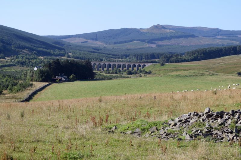
Entry Name: Shankend Viaduct
Listing Name: Shankend Viaduct
Listing Date: 16 March 1971
Category: B
Source: Historic Scotland
Source ID: 332901
Historic Scotland Designation Reference: LB2064
Building Class: Cultural
ID on this website: 200332901
Location: Cavers
County: Scottish Borders
Electoral Ward: Hawick and Hermitage
Parish: Cavers
Traditional County: Roxburghshire
Tagged with: Arch bridge Stone bridge Railway viaduct
15 tall arches carrying railway across Langside valley.
External links are from the relevant listing authority and, where applicable, Wikidata. Wikidata IDs may be related buildings as well as this specific building. If you want to add or update a link, you will need to do so by editing the Wikidata entry.


