Approximate Location Map
Large Map »
Latitude: 56.0825 / 56°4'57"N
Longitude: -3.7934 / 3°47'36"W
OS Eastings: 288490
OS Northings: 689195
OS Grid: NS884891
Mapcode National: GBR 1J.NZPZ
Mapcode Global: WH5QL.PCTX
Plus Code: 9C8R36M4+2J
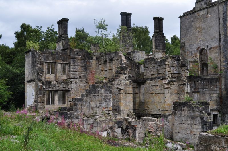
Entry Name: Dunmore Park
Listing Name: Dunmore Park
Listing Date: 25 October 1972
Category: B
Source: Historic Scotland
Source ID: 332936
Historic Scotland Designation Reference: LB2093
Building Class: Cultural
ID on this website: 200332936
Location: Airth
County: Falkirk
Electoral Ward: Carse, Kinnaird and Tryst
Parish: Airth
Traditional County: Stirlingshire
Tagged with: Country house
Ruined gothic mansion, partly demolished tudor design by
William Wilkins 1820-22.
External links are from the relevant listing authority and, where applicable, Wikidata. Wikidata IDs may be related buildings as well as this specific building. If you want to add or update a link, you will need to do so by editing the Wikidata entry.


Other nearby listed buildings
