Approximate Location Map
Large Map »
Latitude: 56.2921 / 56°17'31"N
Longitude: -2.9711 / 2°58'16"W
OS Eastings: 339987
OS Northings: 711497
OS Grid: NO399114
Mapcode National: GBR 2J.7JG2
Mapcode Global: WH7S9.B3FQ
Plus Code: 9C8V72RH+RG
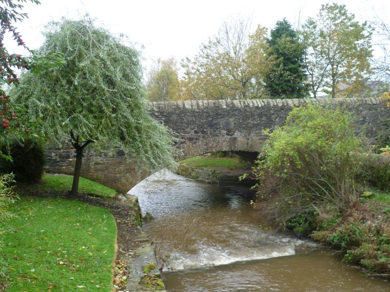
Entry Name: Bow Butts Bridge, Ceres Burn
Listing Name: Bow Butts Bridge over Ceres Burn Including Parapet Walls of Approaches
Listing Date: 10 August 1972
Category: B
Source: Historic Scotland
Source ID: 333326
Historic Scotland Designation Reference: LB2408
Building Class: Cultural
Also known as: Ceres Burn, Bow Butts Bridge
ID on this website: 200333326
Location: Ceres
County: Fife
Electoral Ward: Cupar
Parish: Ceres
Traditional County: Fife
Tagged with: Road bridge
Dated ANNO DOMINI 1831 on inset stone. Single segmental arch,
rubble, dressed voussoirs.
External links are from the relevant listing authority and, where applicable, Wikidata. Wikidata IDs may be related buildings as well as this specific building. If you want to add or update a link, you will need to do so by editing the Wikidata entry.


Other nearby listed buildings
