Approximate Location Map
Large Map »
Latitude: 57.4507 / 57°27'2"N
Longitude: -2.6876 / 2°41'15"W
OS Eastings: 358834
OS Northings: 840248
OS Grid: NJ588402
Mapcode National: GBR M9Q1.3HK
Mapcode Global: WH7LM.PZDM
Plus Code: 9C9VF826+7X
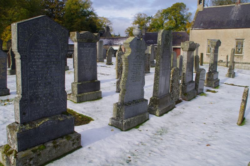
Entry Name: Churchyard, Drumblade Parish Church
Listing Name: Drumblade Parish Churchyard.
Listing Date: 11 September 1984
Category: C
Source: Historic Scotland
Source ID: 333909
Historic Scotland Designation Reference: LB2935
Building Class: Cultural
ID on this website: 200333909
Location: Drumblade
County: Aberdeenshire
Electoral Ward: Huntly, Strathbogie and Howe of Alford
Parish: Drumblade
Traditional County: Aberdeenshire
Tagged with: Churchyard
Rubble walled enclosure containing several graveslabs of
interest, burial enclosure of General John Gordon of
Culdrain etc.
External links are from the relevant listing authority and, where applicable, Wikidata. Wikidata IDs may be related buildings as well as this specific building. If you want to add or update a link, you will need to do so by editing the Wikidata entry.


Other nearby listed buildings
