Approximate Location Map
Large Map »
Latitude: 56.5767 / 56°34'36"N
Longitude: -2.5901 / 2°35'24"W
OS Eastings: 363842
OS Northings: 742912
OS Grid: NO638429
Mapcode National: GBR VV.MNFL
Mapcode Global: WH8S2.5YVK
Plus Code: 9C8VHCG5+MW
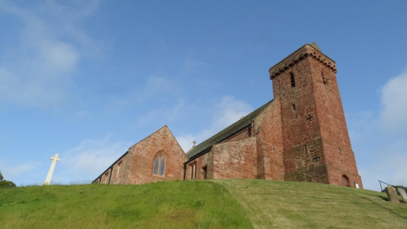
Entry Name: St Vigeans Parish Church And Churchyard, Kirkstyle, St Vigeans
Listing Name: St. Vigeans Parish Kirk
Listing Date: 11 June 1971
Category: A
Source: Historic Scotland
Source ID: 336066
Historic Scotland Designation Reference: LB4770
Building Class: Cultural
ID on this website: 200336066
Location: Arbroath and St Vigeans
County: Angus
Electoral Ward: Arbroath West, Letham and Friockheim
Parish: Arbroath And St Vigeans
Traditional County: Angus
Tagged with: Church building
Aisled oblong with west tower and polygonal apse as
restored in 1871 by Sir R. Rowand Anderson, arch.
Incorporates 12th cent. gables, 15th cent. tower and
arcading and Celtic stones built into the fabric.
Picturesque and elevated site.
Ecclesiastical, in use as such.
External links are from the relevant listing authority and, where applicable, Wikidata. Wikidata IDs may be related buildings as well as this specific building. If you want to add or update a link, you will need to do so by editing the Wikidata entry.


Other nearby listed buildings
