Approximate Location Map
Large Map »
Latitude: 56.7176 / 56°43'3"N
Longitude: -2.6993 / 2°41'57"W
OS Eastings: 357293
OS Northings: 758656
OS Grid: NO572586
Mapcode National: GBR WV.ZV0H
Mapcode Global: WH7Q9.HFT1
Plus Code: 9C8VP892+37
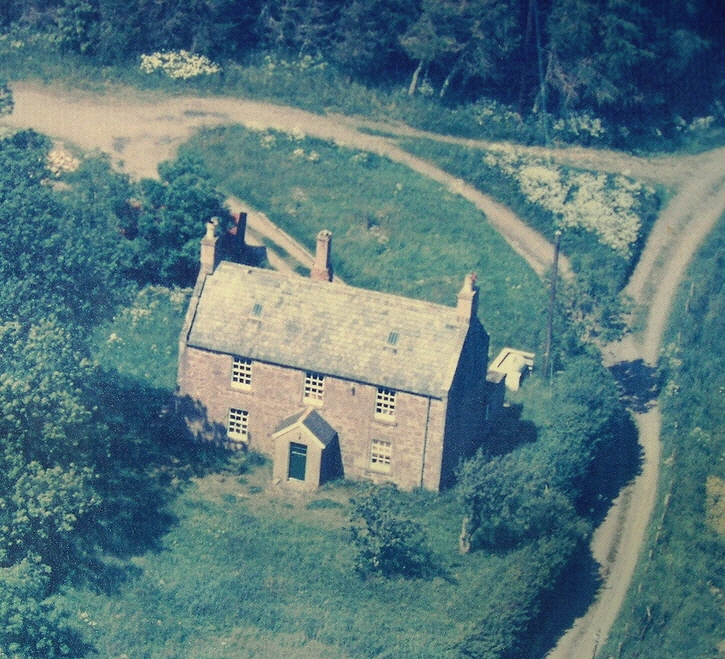
Entry Name: Blaikie Mill
Listing Name: Blaikie Mill Farmhouse
Listing Date: 15 January 1980
Category: C
Source: Historic Scotland
Source ID: 336253
Historic Scotland Designation Reference: LB4939
Building Class: Cultural
ID on this website: 200336253
Location: Aberlemno
County: Angus
Electoral Ward: Brechin and Edzell
Parish: Aberlemno
Traditional County: Angus
Tagged with: Farmhouse
Plain two-storey, rubble and slate. Early 19th century
with modern projecting porch.
External links are from the relevant listing authority and, where applicable, Wikidata. Wikidata IDs may be related buildings as well as this specific building. If you want to add or update a link, you will need to do so by editing the Wikidata entry.


Other nearby listed buildings
