Approximate Location Map
Large Map »
Latitude: 56.6894 / 56°41'21"N
Longitude: -2.7812 / 2°46'52"W
OS Eastings: 352247
OS Northings: 755571
OS Grid: NO522555
Mapcode National: GBR VQ.3L08
Mapcode Global: WH7QG.74W4
Plus Code: 9C8VM6Q9+QG
Entry Name: Churchyard, Aberlemno Parish Church
Listing Name: Parish Kirkyard
Listing Date: 11 June 1971
Category: B
Source: Historic Scotland
Source ID: 336262
Historic Scotland Designation Reference: LB4948
Building Class: Cultural
ID on this website: 200336262
Location: Aberlemno
County: Angus
Electoral Ward: Brechin and Edzell
Parish: Aberlemno
Traditional County: Angus
Tagged with: Churchyard
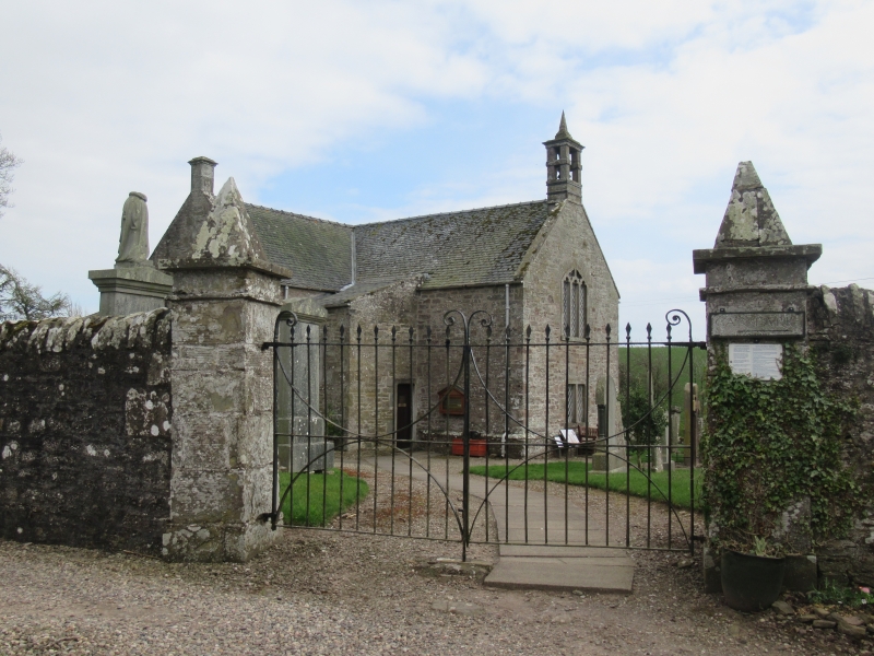
Walls average six feet high rubble, enclosing walls;
early 19th century gatepiers, ashlar with pyramidal tops.
Manse entrance to yard has classic gatepiers of 18th
century date.
External links are from the relevant listing authority and, where applicable, Wikidata. Wikidata IDs may be related buildings as well as this specific building. If you want to add or update a link, you will need to do so by editing the Wikidata entry.


Other nearby listed buildings
