Approximate Location Map
Large Map »
Latitude: 56.6888 / 56°41'19"N
Longitude: -2.7808 / 2°46'51"W
OS Eastings: 352267
OS Northings: 755501
OS Grid: NO522555
Mapcode National: GBR VQ.3L2P
Mapcode Global: WH7QG.841M
Plus Code: 9C8VM6Q9+GM
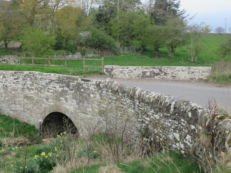
Entry Name: Bridge, Aberlemno
Listing Name: Aberlemno Bridge over Henwell Burn
Listing Date: 15 January 1980
Category: C
Source: Historic Scotland
Source ID: 336267
Historic Scotland Designation Reference: LB4953
Building Class: Cultural
ID on this website: 200336267
Location: Aberlemno
County: Angus
Electoral Ward: Brechin and Edzell
Parish: Aberlemno
Traditional County: Angus
Tagged with: Road bridge
Single segmental arch, rubble. 1774, widened west side
19th century.
External links are from the relevant listing authority and, where applicable, Wikidata. Wikidata IDs may be related buildings as well as this specific building. If you want to add or update a link, you will need to do so by editing the Wikidata entry.


Other nearby listed buildings
