Latitude: 56.3697 / 56°22'11"N
Longitude: -3.9843 / 3°59'3"W
OS Eastings: 277533
OS Northings: 721480
OS Grid: NN775214
Mapcode National: GBR 19.2QVP
Mapcode Global: WH4N0.R5X7
Plus Code: 9C8R9298+V7
Entry Name: Ruchilbank, Dalginross
Listing Name: Ruchilbank, Dalginross
Listing Date: 18 October 1977
Category: C
Source: Historic Scotland
Source ID: 336715
Historic Scotland Designation Reference: LB5301
Building Class: Cultural
ID on this website: 200336715
Location: Comrie
County: Perth and Kinross
Electoral Ward: Strathearn
Parish: Comrie
Traditional County: Perthshire
Tagged with: Architectural structure
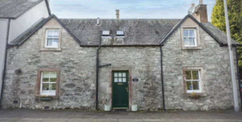
Earlier 19th century. Single-storey and attic 2-window and
centre door, attic windows in gablets over ground floor
windows, painted lined stucco, slated roof.
Reconstruction of cottage of c.1770 ground floor windows and
door probably of that date.
External links are from the relevant listing authority and, where applicable, Wikidata. Wikidata IDs may be related buildings as well as this specific building. If you want to add or update a link, you will need to do so by editing the Wikidata entry.


Other nearby listed buildings