Latitude: 56.5652 / 56°33'54"N
Longitude: -3.5849 / 3°35'5"W
OS Eastings: 302701
OS Northings: 742599
OS Grid: NO027425
Mapcode National: GBR V2.RC37
Mapcode Global: WH5NC.X72V
Plus Code: 9C8RHC88+32
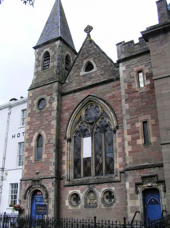
Entry Name: Masonic Temple, Tay Terrace, Dunkeld
Listing Name: Masonic Temple, United Lodge of Dunkeld No. 14-152 (Former Free Church), Boat Road.
Listing Date: 5 October 1971
Category: C
Source: Historic Scotland
Source ID: 337080
Historic Scotland Designation Reference: LB5597
Building Class: Cultural
ID on this website: 200337080
Location: Dunkeld and Dowally
County: Perth and Kinross
Electoral Ward: Strathtay
Parish: Dunkeld And Dowally
Traditional County: Perthshire
Tagged with: Architectural structure
Rubble geometrical facade flanked by twin narrow towers,
western 85' with small belfry and pyramid slated spirelet:
1874-5.
Re-categorised as C(S) from B for Group (2006). The listing relates specifically to the group interest of the subject. It applies, as always, to interior as well as exterior, as appropriate to building type.
External links are from the relevant listing authority and, where applicable, Wikidata. Wikidata IDs may be related buildings as well as this specific building. If you want to add or update a link, you will need to do so by editing the Wikidata entry.


Other nearby listed buildings