Approximate Location Map
Large Map »
Latitude: 56.1569 / 56°9'24"N
Longitude: -4.1129 / 4°6'46"W
OS Eastings: 268860
OS Northings: 698037
OS Grid: NS688980
Mapcode National: GBR 14.J5Z2
Mapcode Global: WH4NX.SHNW
Plus Code: 9C8Q5V4P+QR
Entry Name: Craighead Farm
Listing Name: Craighead, Farmhouse
Listing Date: 6 September 1979
Category: C
Source: Historic Scotland
Source ID: 340205
Historic Scotland Designation Reference: LB8130
Building Class: Cultural
ID on this website: 200340205
Location: Kincardine (Stirling)
County: Stirling
Electoral Ward: Trossachs and Teith
Parish: Kincardine (Stirling)
Traditional County: Perthshire
Tagged with: Farmhouse
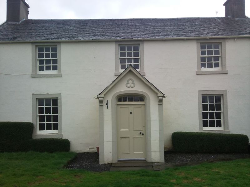
2-storey 3-window stuccoed, porch with semi elliptical
doorway and trefoil above. Mid 19th cent. in present form.
External links are from the relevant listing authority and, where applicable, Wikidata. Wikidata IDs may be related buildings as well as this specific building. If you want to add or update a link, you will need to do so by editing the Wikidata entry.


