Approximate Location Map
Large Map »
Latitude: 56.2984 / 56°17'54"N
Longitude: -2.6589 / 2°39'32"W
OS Eastings: 359318
OS Northings: 711973
OS Grid: NO593119
Mapcode National: GBR 2X.72LC
Mapcode Global: WH8TD.4Y3F
Plus Code: 9C8V78XR+9C
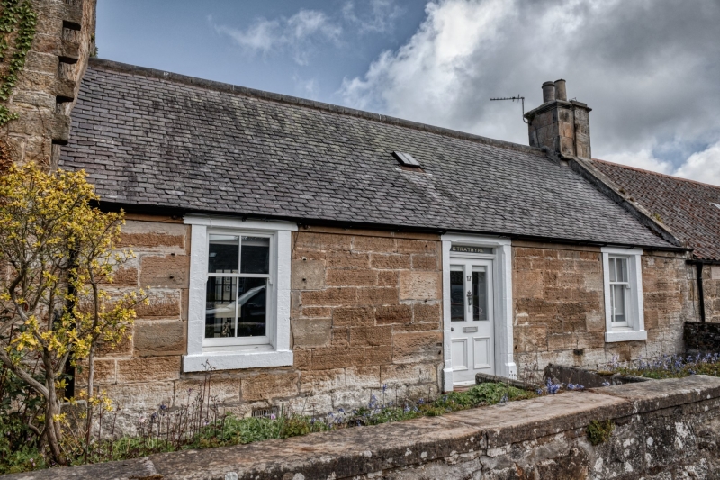
Entry Name: Strathyre, 17 Main Street, Kingsbarns
Listing Name: Strathyre Main Street
Listing Date: 23 November 1971
Category: B
Source: Historic Scotland
Source ID: 340928
Historic Scotland Designation Reference: LB8728
Building Class: Cultural
Also known as: Kingsbarns, 17 Main Street, Strathyre
ID on this website: 200340928
Location: Kingsbarns
County: Fife
Electoral Ward: East Neuk and Landward
Parish: Kingsbarns
Traditional County: Fife
Tagged with: Architectural structure
Dated 1824. Plain single-storey cottage, eaves course continuous with belt course of above, 2 window and centre door with painted margins, pantiled.
External links are from the relevant listing authority and, where applicable, Wikidata. Wikidata IDs may be related buildings as well as this specific building. If you want to add or update a link, you will need to do so by editing the Wikidata entry.


Other nearby listed buildings
